 |
Previous: First results: VMR maps of the observed species Next: Bibliography Up: Ext. Abst.
Validation of SAFIRE/A results
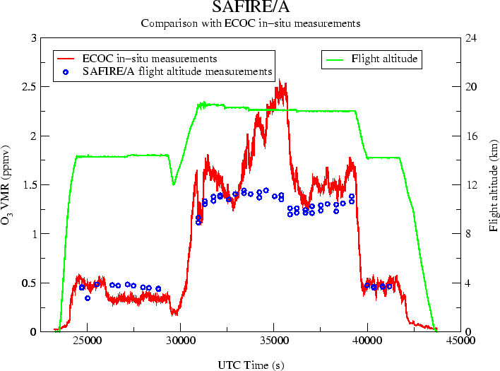
A test and validation of SAFIRE/A data analysis process is given by the comparison of ozone VMR values at flight altitude obtained from in-situ instruments and corresponding SAFIRE-A retrieved VMR values. In figure 5 is shown the comparison between ozone VMR at flight altitude as measured by the ECOC in-situ ozone sonde and SAFIRE-A during the 8/10/1999 scientific flight.
|
A general agreement is present between the two datasets in figure 5, as well as some occasional differences that are being analysed in order to understand how in-situ and remote sensing instruments may respond to atmospheric gradients.
Further validation of SAFIRE/A results come from the comparison of ozone VMR vertical profiles with those obtained from the MIPAS-STR [3] mid-infrared limb sounding FT spectrometer and from balloon-borne ozonesonde launched from the Marambio Antarctic base while the M55-Geophysica was flying over the base (figure 6).
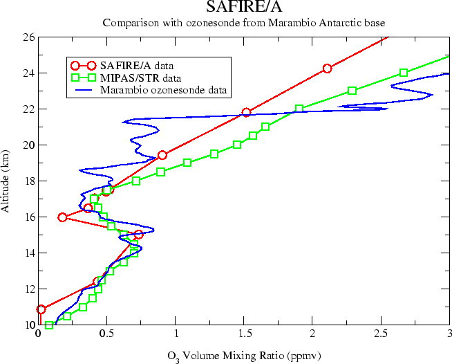 |
Even in this case we notice a good agreement, considering that the accuracy of data retrieved from limb sounding instruments is better near or below flight altitude.