 |
Stratospheric Processes And their Role in Climate
|
||||||||
| Home | Initiatives | Organisation | Publications | Meetings | Acronyms and Abbreviations | Useful Links |
![]()
|
Stratospheric Processes And their Role in Climate
|
||||||||
| Home | Initiatives | Organisation | Publications | Meetings | Acronyms and Abbreviations | Useful Links |
![]()
The stratosphere has already shown the most spectacular anthropogenic changes of any atmospheric region. The discovery of the Antarctic ozone hole in 1985 intensified interest in carefully monitoring the ozone depletion all over the globe. More than twelve years later, one can say that although a quite good description of the decreases in the total ozone column is available, changes in the vertical distribution of ozone, particularly around the tropopause, are poorly known, and this is the region where ozone changes have the strongest effect on climate. The radiative effect of water vapour makes it the most important of the greenhouse gases, and its concentration might be expected to change through the increase and subsequent oxidation of methane, as well as from changes in the atmospheric thermal structure.
The SPARC SSG decided to initiate three activities regarding the changing stratospheric climate : an assessment of trends in the vertical distribution of ozone, encouragement of measurements of the distribution of water vapour and monitoring changes in this distribution (which have a very high priority), and finally an assessment of trends in stratospheric temperatures. SPARC’s goal is to improve documentation of the variations occurring in the stratosphere, whether they are natural or of anthropogenic origin, so that stratospheric changes may be better understood and modelled. A better comprehension of variability of natural forcing is needed in order to improve understanding of the changes in anthropogenic forcing.
During the last decade, the stratosphere has experienced changes as a consequence of various naturally occurring effects. The impact of aerosols deposited in the stratosphere by a major volcanic eruption has been measured accurately and globally for the first time in surface temperature, in addition to its direct effect at other altitudes and its indirect effect through affecting stratospheric chemistry. It should be noted that the monitoring of any long term trend in background aerosol is difficult due to the long residence time of volcanic aerosol reaching the stratosphere (~5 years). IGAC have taken a number of initiatives with regard to monitoring and studying atmospheric aerosol which the SPARC SSG follows closely.
In addition to the rather direct radiative effects and the indirect chemical effects discussed above, there is also the possibility of more complicated changes occurring through changes in atmospheric dynamics.
Finally, SPARC is concerned with changes in the UV radiation field which result from changes in stratospheric ozone, impacting UV penetration at ground level and upper tropospheric chemistry. The SSG maintains close contact with the WMO Global Atmosphere Watch who lead activities in this domain through their Scientific Committee on UV monitoring. Joint activities with IGAC in this area are being explored, particularly on the impact of UV changes on upper tropospheric chemistry.
Ozone is one of the most important radiative gases in the stratosphere and the troposphere. Its role is complex as it is able to absorb the incoming solar ultraviolet (UV) and visible radiation and to absorb as well as emit the outgoing terrestrial infrared (IR) radiation. Consequently, changes in ozone concentrations affect climate, with the effect depending on the altitudes where changes in ozone occur. The most sensitive region is the lower stratosphere and upper troposphere. A great deal of research on atmospheric ozone is carried out for reasons related not to climate, but with stratospheric ozone depletion and increases in UVB at the ground level. A number of assessments have been commissioned in support of the Montreal Protocol which controls the use of the ozone-depleting compounds (e.g., WMO-UNEP, 1995). The SPARC SSG set up its panel on Understanding Ozone Trends (here called the SPARC ozone panel) to deal with the more focused goal of identifying the important issues for climate which are related to ozone.
The 1995 assessment of the Intergovernmental Panel on Climate Change (IPCC) concluded that while the likely long-term increase in tropospheric ozone since pre-industrial times has resulted in a positive forcing (warming tendency) of about 0.4Wm-2 (15% that of the long-lived gases), the observed decrease in stratospheric ozone has caused a negative forcing of about 0.1Wm-2 (IPCC, 1996). A number of recent studies of the radiative forcing of ozone in both the stratosphere and the troposphere (Hansen et al., 1997; Forster et al., 1997; Portmann et al., 1997) have underlined its complexity, particularly its dependence on the altitude, season, and latitude of the ozone changes which have occurred. For instance, Hansen et al. calculate that there has been a net negative forcing from all ozone changes since 1979 which is larger in magnitude than the changes from all the non-CO2 long-lived gases over the same period. One implication of this is that the net greenhouse gas forcing will increase more rapidly if, as expected, stratospheric ozone recovers in the coming decades (see also Solomon and Daniel, 1996). All these studies have suffered from uncertainties in the magnitude of the ozone changes that have actually occurred, particularly those in the sensitive region of the upper troposphere and lower stratosphere.
Changes in the column amount of ozone (total ozone) are well documented (WMO-UNEP, 1995). Satellite instruments have provided near-global measurements since 1979 and the instrumental contribution to the uncertainty in trends is estimated to be an impressive ±1% per decade (McPeters and Labow, 1996). A longer record, albeit with poorer geographic coverage, is provided by the network of ground-based stations with Dobson instruments, many of which date back to the International Geophysical Year in 1957 (Bojkov and Fioletov, 1995). The longest continuous record dates back to the 1920s (Staehelin et al., 1998).
These measurements reveal that long term trends in total ozone have occurred at latitudes poleward of about 30°. The most dramatic manifestations, the Antarctic ozone hole and the smaller loss in the Arctic, clearly result from chemical depletion by halogen compounds. The same compounds are strongly implicated in the total ozone trends observed at mid-latitudes. In the northern mid-latitudes, the decreases average 4-5% per decade since 1979 and are largest in winter and spring. In the southern mid-latitudes the annual losses are similar, but spread more evenly through the year.
The state of knowledge regarding the trends in the vertical distribution of ozone, important in calculating radiative forcing, is not so good. There is fairly good agreement about the magnitude of the trends at altitudes above 20 km or so. However, while it is agreed that most of the trend in total ozone results from changes in the lower stratosphere, there has been poor quantitative agreement between the trends derived from the various data sets (WMO-UNEP, 1995). The main reason is simply that it is very hard to measure ozone concentrations globally, especially in the lower stratosphere. Neither the length nor geographic coverage is as good as for total ozone, and the uncertainties associated with the individual measurements are larger. To confound the picture further, the natural variability of ozone in the lower stratosphere is larger than at higher altitudes.
There are only four main data sets which could be suitable for trend analysis, those from the SAGE and SBUV satellite instruments, from the balloon-borne ozonesondes and with the Umkehr technique using the ground-based Dobson instruments. Of these, only SAGE and ozonesondes have sufficiently high vertical resolution in the lower stratosphere. Long term calibration is a critical issue for all of these data sets and, as with the total ozone measurements, a great deal of work has been done in improving the stability of the data sets. Much of this work has been done in conjunction with the WMO-GAW programme for ozonesonde and Umkehr measurements, and the results to date show that there is still not satisfactory agreement.
Accordingly, the SPARC ozone panel, after consultation with the SPARC SSG and with the wider scientific community, decided to instigate a thorough assessment of the state of knowledge regarding the trends in the vertical distribution. This has been done jointly with the International Ozone Commission (IOC) under the auspices of the WCRP and WMO. The timing is right for a number of reasons, not least being the fact that measurement programmes such as UARS and the NDSC have been running for a few years, allowing stringent examination of the quality of the data for this period. The report and its preparation are described in more detail in the next section.
The second important issue identified by the SPARC ozone panel is that the lessons about producing decadal records of suitably high quality measurements should be applied in the future. A number of bodies have genuine interests in this subject and it is important that SPARC participates in this process. For instance, WMO-GAW has a great deal of experience in co-ordinating an international programme of ozone measurements. Many countries have their own programmes and it is important that these are complementary. The requirements of a future programme and the efforts aimed at ensuring that it is achieved are discussed in part 3(i).
Finally, in part 3(ii), issues related to the understanding of the ozone changes and to predictions of future changes are discussed, in particular the links and possible collaborations of the SPARC ozone programme with the other SPARC panels. Research leading toward a fuller understanding of the observed trends in ozone will involve distinguishing, and then evaluating, the interlinked effects of the chemical and dynamical changes which have also occurred. As such, it is part of the synthesis of the various strands within SPARC to produce a fuller understanding of the interactions of the stratosphere with climate.
The biggest uncertainty concerning ozone trends is in the magnitude of the trends in the altitude region between 15 and 20 km. In the 1994 WMO-UNEP ozone assessment, SAGE was reported as giving trends up to -20±8 % per decade over northern mid-latitudes for the 1980s, where the ozonesonde stations gave a trend of -7±3 % per decade (WMO-UNEP, 1995). Ozone changes in this region are particularly important for climate and so the first action of the SPARC ozone panel was to instigate an assessment of this issue that would be finished in time for use in the 1998 WMO-UNEP report. A number of other international bodies were interested in collaborating and the assessment has been produced jointly with the International Ozone Commission (IOC) under the auspices of the WCRP and the WMO.
A meeting was held in July 1996 at the Observatoire de Haute Provence, France. Over thirty experts came to discuss the scientific issues which should be covered in the assessment as well as to see the ways in which the existing measurement series could be used. The work was split into three main areas:
a) an assessment of how each instrument system and its algorithm works, and of how stable the ozone measurements should be over time,
b) an intercomparison of the various data sets to determine empirically the confidence in the stability of each instrument;
c) the calculation of the trends themselves.
A number of meetings of the different working groups were held in 1997 culminating in a workshop in Abingdon, UK in October 1997, where authors and reviewers worked together to improve the draft report. The final report should be printed in spring 1998 and will be an important contribution to the 1998 WMO-UNEP ozone assessment. A summary of the main findings and lessons learnt is published separately in SPARC Newsletter 10.
Only two measurement techniques have the potential for providing long-term trends of ozone in the low stratosphere, ozonesondes and SAGE. Ozonesondes have been regularly flown from some stations for 30 years or so, but the number of such stations is limited. For a more complete geographic coverage, the SAGE satellite instruments provide a 13 year record for SAGE II on its own or an 18 year record if SAGE I and SAGE II are combined, albeit with a 3 year gap from 1981-84. The report was structured to assess the quality of the SAGE and ozonesonde data sets as thoroughly as possible. The other two long-term data sets (SBUV and Umkehr) are used at higher altitudes where they are most effective, and shorter term data sets such as those from UARS and the NDSC are used for comparative purposes in the low stratosphere. Even with all these measurements, it is clear that insufficient measurements have been made for past trends in tropospheric ozone to ever be determined over most of the globe.
A number of modifications have been made to the SAGE data processing since the 1994 WMO-UNEP assessment, two of which are particularly important as far as ozone trends are concerned. First, an improved altitude registration adjustment has been made to the SAGE I data which increases confidence in the trends above 20km (Wang and Cunnold, 1996) and greatly improves the agreement between the trends found from SAGE, SBUV and Umkehr in the middle and upper stratosphere. Second, the calculation of the aerosol interference to the ozone measurement has been refined, which is important because there have been large changes in the stratospheric aerosol loading since 1979 as a result of volcanic activity. This second factor has reduced the trends in ozone between 15 and 20km and they are now in reasonable agreement with the trends derived from the sondes at northern mid-latitudes.
It was generally felt, however, that confidence in trends (i.e. uncertainties of a few percent per decade) requires two independent measurement systems. The improved agreement in the lower stratosphere at northern mid-latitudes did not greatly increase our confidence in the trends in the tropics and southern mid-latitudes where SAGE measurements alone can be used to determine them. It is essential therefore that more measurements are made in the future and that a well-balanced measurement system or programme is put in place. The contribution of SPARC in the formulation of such a programme is discussed in the next section.
The use of meteorological information was discussed in two contexts. First, novel approaches for data comparison were investigated which show great promise for the future. In these, meteorological information is used to ensure that the measurements used in particular comparisons were made in dynamically similar air masses. This reduces one component of the uncertainty associated with the traditional approach. Second, there have been an increasing number of studies which have looked at how interannual and long-term changes in dynamics affect the ozone distribution and trends. For instance it is important to separate the influence of the changing chemical composition, the solar cycle, climate change and natural variability, in addition to the chemical and dynamical effects of changes in stratospheric aerosol loading. These were discussed in some detail in the assessment, and it is clear that more work will be needed on this in the future (see below). Valid predictions of future changes in ozone can only be made if the already observed changes can be properly accounted for.
The SPARC ozone panel identified the improved understanding of the past changes and trends in the vertical distribution of ozone as the single most important step along the road to achieving a fuller understanding of the links between climate and the observed long-term changes in ozone. The assessment of trends in the vertical distribution of ozone has only just been completed and it is important that all the lessons learnt from that are documented and implemented in the future. One of the first actions for the SPARC ozone panel is to identify what those lessons are.
The SPARC-IOC assessment has revealed the limitations that we face in assessing the quality of the existing data. It is thus important that SPARC remain involved both in encouraging improved analyses of existing data (data archaeology) and in the planning of a future, truly global ozone measurement programme. In this way the requirements for climate studies will be kept at the forefront of discussion. The second strand of research to be pursued is the understanding of past changes and the prediction of future changes, especially how these changes interact and are linked to climate change.
The future programme foreseen by the SPARC ozone panel can thus be divided into two main categories: that related to future measurements, and that related to the basic understanding of past and future ozone changes and the link with climate. In this section the broad areas of scientific interest are described. Some specific action items are mentioned, particularly with regard to future measurements, but in general details will only become clearer as the science develops.
3 (i) Future ozone measurements
Good, long-term measurements of the atmosphere have provided the spur for much of the research on atmospheric ozone in the past decade or so. The Antarctic ozone hole was discovered because the ground-based ozone measurements at Halley Bay and other Antarctic stations were good enough to trust. Our knowledge about ozone globally is now based on both ground and satellite measurements. These complement each other by providing relatively independent checks of each other’s quality and representativeness, and extensive efforts are made to maintain the quality of all these measurements.
It is important to ensure that all our knowledge and experience about collecting high quality data over several decades is brought to bear in planning future ozone measurements. A number of bodies have genuine interests in this subject. WMO-GAW has a great deal of experience in planning and instituting a quality control programme for a number of measurements (including total column and vertical distribution of ozone) made at their associated ground stations. Measurements of ozone and many related stratospheric constituents have been made at the smaller number of sites within the NDSC. NASA and NOAA have now run the TOMS and SBUV satellite instruments for nearly twenty years. Many countries have ozone measurement programmes of one kind or another and it is important that these individual programmes are complementary and neither leave gaps nor needlessly duplicate.
It is clear that any future ozone measurement programme must be internationally agreed if it is to be successful. For instance, atmospheric scientists have long bemoaned the shortage of ground-based ozone measurements in the tropics, particularly of its vertical distribution. Our knowledge of the ozone in this region is based primarily on satellite observations. (A similar situation exists regarding meteorological measurements.) This shortage of ground-based measurements has had one important consequence - it has been much harder to validate the satellite measurements in the tropics than at mid-latitudes which is important because there are real geophysical differences between the vertical distributions in these regions.
Any strategy for future long-term measurements must therefore be balanced between ground-based and satellite measurements. Each system must be capable of meeting the goals of their own programmes in terms of long-term stability, temporal and geographic coverage, etc.. Combined with the extra confidence resulting from more stringent validation programmes, all these will be improved. A good ground-based network also provides partial back-up to satellite instruments in the event of unexpected instrument failure.
A number of ground-based instruments have been accepted (or defined) as primary instruments within the WMO-GAW Global Ozone Observing System and within NDSC, allowing a great international pool of expertise to accumulate. To date this has not happened in space instrumentation where it may be even more important. Satellite instruments demand a great deal of resources (scientific and technical expertise in addition to finance) if they are to produce good measurements, and it is important that these resources are not spread too thinly. It is clearly sensible to define an internationally recognised set of satellite-borne ‘primary monitoring instruments’ for measuring both the total column and the vertical distribution of ozone. The technology allowing easy, cheap access to all the data collected is now easily available, and so truly international collaboration on such projects is a real possibility.
A strategy for future ozone measurements (‘Long-term Continuity in Ozone Measurements) is currently being developed as part of the CEOS-IGOS strategic implementation plan. Scientists from many countries are involved, including members of the SPARC ozone panel. While it will not be the major activity of this SPARC panel, it is important that SPARC participates in this process for a number of reasons. First the SPARC community is articulating the medium- and long-term aims of researchers working to understand the lower stratosphere and it is important their views are taken into account in the formulation of such a strategy. Second, the experience gained during the SPARC-IOC assessment of Trends in the Vertical Distribution of Ozone must be fully used. Further, SPARC participation will enhance the cohesion between the strategy for future ozone measurements and the general research aims of SPARC, as outlined in this Implementation plan. Finally, SPARC is well-placed to be an independent advocate for a jointly planned, balanced programme of ground and satellite measurements.
One specific activity where the experience of the scientists involved in the SPARC-IOC assessment should be brought to bear is in the planning of future measurement validation strategies. The intercomparison of measurements made by the different measurement systems contains much information about which approaches are most effective. It will be very important to ensure that the work done for the assessment is re-analysed with the planning of future validations in mind. A clear distinction must be made between the validation of the accuracy and precision of the measurements made by a given instrument and the validation of the stability of its accuracy and precision over time. Questions which could be addressed include:
We propose that a working group including many of the scientists involved in the SPARC-IOC assessment be set up to examine these issues. Close contact must be made with agencies such as WMO-GAW, with individual measurement programmes (e.g., NDSC and particular satellite instruments), and with the panel drawing up the CEOS-IGOS strategic plan. This group will consider the geographic distribution of ground-based measurements stations, particularly ozonesondes and lidars which make high vertical resolution measurements in the lower stratosphere. It is already clear that confidence in global data sets cannot be obtained through comparisons with independent measurements made only at northern mid-latitudes. There are currently an insufficient number of stations in the tropics and in the southern hemisphere, and SPARC adds its strongest support to international efforts to remedy this deficiency.
3 (ii) Understanding ozone trends
The steps outlined in sections 2 and 3(i) related to ozone measurement quality and strategy can be thought of as ‘getting our own house in order’ before attempting to formulate more ambitious plans. In this section, the next steps are discussed, in particular how the work of the SPARC ozone panel can be synthesised with the work of other SPARC panels to advance our understanding of the interactions between the stratosphere and climate. These are, of necessity, more general in nature as this is a field in which an increasing amount of effort is being expended.
Atmospheric halogen levels are anticipated to decline as the provisions of the Montreal Protocol and its subsequent amendments are implemented and recovery of stratospheric ozone is expected. However, it is clear that the stratosphere in the second half of the 21st century (when halogen levels have dropped to ‘pre-ozone hole ‘ levels) will not be the same stratosphere as that in the second half of the 20th century. For instance, chemical emissions of one sort or another (e.g., from aircraft) will continue, and climate is expected to change. There is evidence that long-term changes in the dynamics of the atmosphere, possibly resulting from climate change, make a significant contribution to the observed ozone trends (see Trends in Dynamical Activity). The relationships between stratospheric ozone and radiation, temperature and dynamics is very complicated as the chemical, radiative and dynamic time-scales are similar, each set of processes simultaneously influencing ozone amounts in much of the stratosphere.
While much can be learnt from analyses of the data and the use of simple models, the complexity and inter-dependence of the chemical, radiative and dynamic processes in the stratosphere is such that a full understanding is going to be achieved only with models that describe all these processes. The use of GCMs with realistic upper atmospheres (stratosphere and mesosphere) is going to be an important component of research on both past and future ozone amounts. Research on the detection of climate change in the observational record is now based around sophisticated statistical techniques which combine output from GCM studies with time series of observations of the critical components. It has become clear that both tropospheric and stratospheric ozone can explain some of the features in the observed temperature record, particularly in the vertical distribution of temperature changes.
Accurate prediction of ozone amounts in the next century demands that the effects of any chemical and dynamic changes are quantified. A pre-requisite to achieving this is the ability to explain all the observed changes in the stratosphere, i.e. those in temperature, dynamics, chemical composition and water vapour, as well as in ozone. Increasingly close collaborations with the SPARC panels on these subjects will be required to treat the problem holistically. For instance a number of studies have analysed the long-term observations of ozone together with those of temperature and/or dynamic quantities such as tropopause height (e.g., Hood et al., 1997 and references therein). A critical, currently unresolved issue is whether the short term relationships between such variables, which are generally assumed (implicitly or explicitly) in such studies, will change as climate changes. Whatever the answer to that, these studies do illustrate an increasing emphasis on the quantitative attribution of causes to the observed ozone changes, as has also happened in studies of past temperature trends (IPCC, 1995).
On-going discussions about how to promote such research are being held with the SPARC SSG and with the other SPARC panels, particularly those on temperature trends, water vapour and GCMs. The most likely way forward is through joint workshops and initiatives.
Finally, work will proceed on producing the best estimates of the past forcings of climate from changing ozone amounts for use in climate model and attribution studies of the observed temperature and precipitation records. This work will clearly use the results of the SPARC-IOC assessment, and it will additionally provide best guesses of past changes in regions of the atmosphere where past changes cannot be determined with confidence from high quality observations alone, e.g. in the troposphere. This work could involve a combination of observational and modelling studies, and the uncertainties involved with all estimates will be assessed.
Bojkov, R.D., and V.E. Fioletov, Estimating the global ozone characteristics during the last 30 years, J Geophys. Res., 100, 16,537-16,551, 1995.
Climate Change 1995. Eds. J.T.Houghton, L.G.Meira Filho, B.A.Callander, E.Haites, N.Harris, A.Kattenberg, and K.Maskell, Intergovernmental Panel on Climate Change (IPCC), Cambridge University Press, 1996.
Forster, P.M de F., R.S. Freckleton and K.P. Shine, On aspects of the concept of radiative forcing, Climate Dynamics, 13, 547-560, 1997.
Hansen, J., M. Sato and R. Ruedy, Radiative forcing and climate response, J. Geophys. Res., 102, 6831-6864, 1997.
Hood, L.L, J.P. McCormack and K.Labitzke, An investigation of dynamical contributions to midlatitude ozone trends in winter, J. Geophys. Res., 102, 13,079-13,093, 1997
McPeters, R.D. and G.J. Labow, An assessment of the accuracy of 14.5 years of Nimbus 7 TOMS Version 7 ozone data by comparison with the Dobson network, Geophysical Research Letters, 23, 3695-3698, 1996.
Portmann, R.W., S. Solomon, J. Fishman, J.R. Olson, J.T. Kiehl and B. Briegleb, Radiative forcing of the earth’s climate system due to tropical tropospheric ozone production, J. Geophys. Res., 102, 9409-9417.
Solomon, S. and J.S. Daniel, Impact of the Montreal Protocol and its amendments on the rate of change of global radiative forcing, Clim. Change, 32, 7017, 1996
Staehelin, J., R. Kegel, and N.R.P. Harris, Trend Analysis of the Homogenised Total Ozone Series of Arosa (Switzerland), 1926-1996, sub. to J. Geophys. Res., 1998.
Wang, H. J., D. M. Cunnold, and X. Boa, A critical analysis of SAGE ozone trends, J. Geophys. Res., 101, 12,495-12,514, 1996.
WMO/UNEP, Scientific assessment of ozone depletion: 1994, Global Ozone and Monit. Network, WMO. Report No. 37, Geneva, 1995.
One of the most immediate areas of interest to SPARC is the distribution of water vapour in the upper troposphere and lower stratosphere (UT/LS) because of its critical role in Earth's radiative budget and therefore in climate questions. A working group was established to look into the present state of observational capabilities, and the data that is now available.
It was also charged with developing a plan of action by which the observational capabilities could be marshalled to obtain the data that would lead to a much improved knowledge of this critical species. This document is the first step in developing such a plan. It was developed by the Ad Hoc SPARC Water Vapour Advisory Group, some of whose members are members of the SPARC Water Vapour Working Group. It is designed to be the first step in an iterative process, and will serve as the basis for a more broadly based meeting in 1998 to further develop the plan, and put it into a form that can be used as the basis for detailed implementation.
This section begins with a brief discussion of the importance of UT/LS water, followed by a synopsis of the present state of knowledge, and some general considerations for a measurement strategy. It is followed by a section discussing plans for determining the present water vapour distribution, through the use of satellite and in-situ data, and another on mainly in situ measurements to understand the mechanisms that maintain that distribution. It closes with sections on requirements for new instrumentation, co-operation in international programs, and a summary.
(i) - Importance for Earth's radiative balance
Water vapour is the most important greenhouse gas, although it has not received the attention paid to the anthropogenic greenhouse gases. It has long been recognised as crucial in determining the radiative balance of the Earth. Recently it has been re-emphasised that the far infra-red component of the water vapour emission plays a significant role in the water vapour greenhouse effect (Clough et al., 1992, Sinha and Allen, 1994, Sinha and Harries, 1995). Sinha and Harries (1995) clearly demonstrate that most of the greenhouse trapping due to water vapour absorption occurs in the middle and upper troposphere. They also show that in the tropical troposphere a relatively small change of the water vapour abundance (17%) will produce the same greenhouse forcing as doubling the CO2 concentrations. Since 17% is comparable to the uncertainty in radiosonde measurements of upper troposphere humidity (Liu et al., 1991), those data are not sufficient for studies of Earth's radiative balance. More accurate knowledge is required.
(ii) - Role as a tracer
Recent observations of the so-called tape recorder effect (Mote et al., 1995,1996) illustrate that water vapour is an excellent tracer for stratosphere-troposphere exchange processes in the tropics, and point out that the water vapour mixing ratio is an aid to distinguishing between stratospheric and tropospheric air in the "middleworld". There appears to be strong quasi-horizontal exchange along isentropes in the 315- 370 K range. In order to evaluate the amount of stratospheric air moving into the upper tropical troposphere, and tropospheric air moving into the extra tropical stratosphere along isentropic surfaces, as well as the extent of mixing, the water vapour mixing ratio provides an important tracer. Model studies (e.g. Eluszkiewicz, 1996) suggest that quasi-horizontal exchange at 350 K is more vigorous in summer than winter, but this has not been verified by observations. Careful observation of the water vapour and ozone distributions are probably the best observational test. In addition, in mid-latitudes around 215 hPa the water vapour mixing ratio (averaged over a 3 km deep layer) is anti-correlated with potential vorticity (PV) in a way consistent with vertical motions bringing dry stratospheric air with high PV down, and moist, low PV tropospheric air up (Stone et al., 1996).
(iii) - Chemical considerations
In addition, water vapour is the source of hydroxyl radicals, responsible for much of the oxidising capacity of the atmosphere, and therefore critical for cleansing the atmosphere of many anthropogenic compounds dumped into the atmosphere. It is also involved in hydrolysis reactions that are important for the removal of reactive chlorine and nitrogen species.
(iv) - Requirements on knowledge of the water vapour distribution
The radiative requirements may place the most critical requirements on the measurement accuracy, and suggest that an accuracy no worse than 10% is needed. Similarly, use of water vapour as a tracer suggests that a precision of 5-10% is also needed. The spatial and temporal resolution depend on the application of the data; studies of mechanisms will require smaller spatial and temporal measurement scales than the establishment of a baseline climatology.
It has been recognised since the work of Brewer (1949) that only if nearly all air entering the stratosphere passes through the cold tropical tropopause where it is "freeze dried" can the observed aridity of the stratosphere be accounted for. To be effective, the Brewer model requires that ice (or water) particles formed during passage through the tropopause be able to sediment out before re-evaporation, so that the water is irreversibly removed from parcels entering the stratosphere. The precise processes by which this dehydration occurs, and the temporal and spatial variability of the dehydration process, remain very uncertain. A review of the status of this subject is provided in Holton et al. (1995).
According to our current understanding, the region around the tropical tropopause represents an important transition region in the control of the water vapour distribution. Below the tropical tropopause water is supplied by rapid vertical transfer in convectively active regions, followed by horizontal advection into undisturbed regions. Well above the tropopause (above 18-20 km) vertical transfer of water is through advection by a non-locally controlled global-scale meridional circulation driven by wave breaking in the extra-tropical stratosphere. This global-scale circulation slowly but steadily pulls air upward and poleward across the isentropes (accompanied by diabatic heating), and thus circulates the air dehydrated by passage through the tropical tropopause throughout the stratosphere (Holton et al., 1995). As air is pulled upward in this circulation it preserves the signature of its water vapour mixing ratio at entry into the stratosphere. Satellite data suggests that upward advection by this global-scale circulation in the lower tropical stratosphere is of the order of only 30 meters per day. The annual variation of tropopause temperature, and hence of saturation mixing ratio at the tropopause, is clearly preserved in the vertical profile as air is pulled up from the vicinity of the tropical tropopause (Mote et al., 1996, Abbas et al.., 1996a).
Methane (CH4) is closely involved with the water distribution, since methane is oxidised to water vapour as it ascends, one methane molecule resulting in very nearly 2 water vapour molecules (Abbas et al., 1996b, Mote et al., 1996). Thus, H2O + 2(CH4) is nearly constant. By plotting methane against water vapour, their relationship, and the mean water vapour mixing ratio at the tropical tropopause can be determined from a much larger set of data. Thus simultaneous measurements of methane are very valuable in interpreting the water measurements.
These general considerations are borne out by the seasonal zonal mean profiles of water vapour mixing ratios that have been derived from the Stratospheric Aerosol and Gas Experiment II (SAGE II, described below) by Chiou et al.. (1997). These indicate a number of interesting features: (1) a region of minimum water vapour mixing ratio (the hygropause) has been found in all latitude bands; (2) the distances between the tropopause and hygropause altitudes vary between 1 km to 4 km, being greater at higher latitudes; (3) most well defined hygropauses appear at low latitudes (20°S-20°N); (4) the smallest water vapour mixing ratios at lower latitudes appear in December-January-February for both hemispheres; and (5) for all latitude bands there is a consistent positive poleward gradient of water vapour mixing ratio at constant altitudes throughout the lower and middle stratosphere. These features are also shown by the reference models for water vapor now being developed by Chiou et al.. (1996) based on a number of satellite data sets, and on a reference atmosphere based on the UARS data now being created (H. Pumphrey, personal communication, 1998).
In addition, SAGE II water vapour measurements clearly indicate that increased convection in the summer hemisphere is associated with a more moist middle and upper troposphere. Analyses by Rind et al. (1991) and Del Genio et al. (1994) of SAGE II data showed that, in a seasonal sense, more convection results in larger water vapor mixing ratios in the UT/LS. A subsequent study by Loiu and Rind (1997) focussing on individual events indicates a complex, time dependent behaviour, which differs from the tropics to mid-latitudes.
Rosenlof et al. (1997) have analysed satellite and in-situ aircraft water vapour measurements, and find that both indicate that the Southern Hemisphere lower stratosphere is drier than the Northern Hemisphere, as a result of the interplay of a number of factors. High southern latitudes are dehydrated by the low temperatures in the Antarctic polar vortex in late winter and spring. The tropical regions are controlled by the seasonal cycle in tropical water vapour, while mid-latitudes see an interplay between quasi-horizontal exchange from the tropics and large scale vertical descent. One result is that the base of the "overworld" is near 60 hPa in the tropics, and thus good observations are required at least up to that level.
It is the layer of the atmosphere in the vicinity of the tropical tropopause, where water vapour mixing ratios change from hundreds of ppmv to ~3 ppmv, in which our understanding of processes controlling the water distribution is still very uncertain. Some investigators have argued that overshooting cumulus convection and resulting mesoscale cirrus anvil clouds could account for the dehydration process in the tropopause region (Danielsen, 1982). Analysis of satellite data (Wang et al., 1994), aircraft observations (Heymsfield, 1986) and recent investigations with airborne lidar (Schoeberl and Toon, personal communication) indicate the presence of very large-scale layers of optically thin cirrus at the tropical tropopause. These observations suggest that large-scale slow vertical ascent may control the flux of water into the stratosphere. Little is known, however about the microphysical and radiative characteristics of the sub-visible cirrus near the tropical tropopause. Thus, it is not possible at present to know whether such cirrus are diabatically warming and acquiring stratospheric potential temperatures, or whether particle growth and sedimentation are rapid enough to account for the required dehydration. Moyer et al. (1996) showed that the concentration of deuterated water could provide additional information on these processes; using HDO concentrations from ATMOS, they showed that the water vapor was depleted in deuterated water, but not as much as expected under equilibrium conditions. Their conclusion was that the predominant source of water vapor in the uppermost troposphere is either evaporated cloud ice, or troposphere-stratosphere transport occurs closely associated with tropical deep convection. In order to understand the cross-tropopause flux of water vapour in the tropics it appears to be necessary to determine the relative roles of overshooting convection and large-scale cirrus. Careful in-situ radiative and microphysical measurements as well as modelling studies will be required, over all seasons, and at a range of locations.
In addition, as noted above, appreciable exchange between the troposphere and the lowermost stratosphere may take place along isentropic surfaces, as noted by Dessler et al.(1995) and Pan et al. (1997).
Given the importance of UT/LS water vapour, a number of issues immediately arise. The first is that we do not really know the present distribution of water vapour and its temporal variations in the tropopause region well enough; this must be the first question to address.
However, this information will be of limited use if we do not understand the processes that maintain this distribution. Such an understanding is a minimum requirement to being able to develop a capability to model the present distribution mechanistically, and more importantly, to predict its future evolution under changing conditions, such as the continued increase of greenhouse gases in the atmosphere. Thus, such process studies must also have a very high priority.
The distribution of water in this cold region is complicated by the nature of water substance, and its phase changes. In the high troposphere water vapour can be in equilibrium with ice crystals, and move from one phase to another. Measurements must take this into account, and allow for water in both forms in determining the mean distribution, and the controlling mechanisms.
Presently available data suggests that water vapour, especially in the tropics, varies on a range of horizontal scales from global to regional down to the size of large convective systems. Vertical scales as fine as a few meters may be important in some cases. There is also a range of temporal scales, from annual and seasonal to a few hours, corresponding to the spatial scales. These facts imply that more than one type of observing campaign and a wide range of observing techniques will be required. They also indicate that considerable scientific imagination will be needed to construct empirical models and develop a mechanistic understanding of the ways the water distribution is maintained, and of its natural variations.
Finally, it follows from the above that a vigorous modelling effort must accompany any measurement program. As the measurements will span a wide range of scales, a hierarchy of models is also called for. The goals are to aid in the interpretation of the data, suggest new measurements that are needed, and ultimately allowing mechanistic and parameterised calculations to be carried out within large climate models.
(i) - Observational considerations
Determination of the global distribution of water vapour requires global observations. For temperature the initial distributions were developed from operational radiosonde measurements obtained for forecasting purposes. The radiosondes also carry sensors for water vapour, but at best they are trustworthy at altitudes below the 400 mbar pressure level. Generally these sensors do not provide useful measurements above the mid-troposphere. In the regions of interest a sensor must be capable of measuring mixing ratios from a few hundred to a few parts per million (ppm). The operational satellite sounders that provide global temperature soundings also provide some information on water vapour, but because of the nadir-viewing geometry and low water vapour optical depths, cannot provide data with the necessary vertical resolution and accuracy.
Useful data in this part of the atmosphere have been provided by 3 types of observation with complementary characteristics.
1) Research satellite instruments have obtained global long term measurements. These have all involved looking at the earth's limb, either in emission or in occultation, to provide vertical resolutions as fine as about 1 km, and horizontal resolution from a few km. (For example, Chiou et al. (1993b) demonstrated that SAGE II could measure column water vapour from 100 mbar to 300 mbar from 0.002 gm/cm2 to 0.01 gm/cm2, a factor of 100 to 1000 smaller than the columnar water vapour content measurable by nadir viewing satellite instruments). Those using infrared wavelengths cannot see through high clouds, and so their lower altitudes are limited by cloud top heights. Microwave wavelengths do not suffer from this limitation, but in general have lower vertical resolution. The great advantage of the satellite techniques is that a single instrument is used everywhere, taking a large number of observations, so that random errors can be averaged out, allowing spatial and temporal variations to be detected. However, because of the indirect nature of the observations, the accuracy is more difficult to determine, and usually must be verified through comparison with in-situ observations, which have their own uncertainties.
2) Historically, the first measurements were obtained by in situ observations from aircraft, and subsequently from balloons. Their coverage is clearly limited in time and space, but some are capable of rapid response, which translates into spatial resolutions of a few meters. By virtue of being able to be calibrated just before, and in some cases just after flight, absolute accuracy should be well controlled, although some differences between sensor types still need explanation. Current aircraft platforms available for observations in this part of the atmosphere include research aircraft, such as NASA’s ER-2 and WB-57 aircraft, and the Russian Geophysica, which can operate in the neighbourhood of 20 km. Instrumentation for these platforms includes frost-point hygrometers, Lyman alpha sensors, and tunable diode laser (TDL) devices. Laboratory comparisons of in situ instruments indicate agreement to within a few percent, which is better than their error budgets. Field measurements have disagreed by as much as ±20 %, for reasons that are not understood. The agreement in the laboratory suggests that a goal of ±5% for field measurements is reasonable. Flying the principal instrument types on a common platform will eliminate the differences resulting from different platforms sampling different air masses, especially for a species like water vapour where small-scale variability has been observed.
3) More recently, ground-based remote sensing techniques have been developed. Passive techniques do not have the high vertical resolution desired, but active techniques, such as Raman lidar and Differential Absorption Lidar (DIAL) techniques can provide high vertical resolution, and extensive time series at a single location. For these observations the difficulty is often in obtaining sufficient returned signal from the tropopause region, and again the verification of accuracy, but relative changes over time should be observable. In particular, the observatories of the Network for the Detection of Stratospheric Change (NDSC) will soon be making measurements of UT/LS water vapour and will deploy high quality instruments for making ground-based measurements; these will be a major source of data for any global measurement program.
More recently a new source of data, obtained by regular flights of carefully maintained and calibrated instruments on commercial aircraft, over a wide range of routes and for several years, has come into being. The Measurement of Ozone by Airbus In Service Aircraft (MOZAIC) program has obtained a large number of data on water vapour plus ozone and supporting meteorological parameters like temperature, pressure and wind. These aircraft, flying long stretches in the upper troposphere and lower stratosphere, are now beginning to provide detailed data on many complex structures in this region of the atmosphere. These data will add greatly to our knowledge of mean distributions, and to mechanisms of stratosphere-troposphere exchange.
The proposed approach to develop a global water vapour climatology is then to make use of present and future satellite instruments to obtain global, long term observations of the spatial and temporal variations of water vapour, to intercompare various satellite observations to reduce systematic effects, and to anchor them as firmly as possible to coincident well-calibrated in-situ aircraft and ground-based observations.
(ii) - Satellite observations now available
Satellite data presently available to begin the development of a water vapour climatology include the second Stratospheric Aerosol and Gas Experiment (SAGE II) on the Earth Radiation Budget Satellite, the Halogen Occultation Experiment (HALOE), and the Microwave Limb Sounder (MLS),both on the Upper Atmosphere Research Satellite, which was launched in September 1991. Brief descriptions of these follow.
SAGE II
The SAGE II instrument, launched from the shuttle in October 1984, is a seven channel visible to near-IR sun photometer that uses the solar occultation technique to provide measurements of atmospheric constituents. An overview of SAGE II is given by McCormick (1987). Each day, about 15 sunrise and 15 sunset profiles are obtained, with successive events separated by about 24 degrees in longitude and less than 1 degree in latitude. The inversion algorithm developed to retrieve the vertical profiles from raw radiance observations is discussed in Chu et al. (1993). The vertical resolution of the data is about 1 km. Currently the SAGE II water vapour data set which covers a period of 5 and 1/2 years (January 1986 through May 1991), is being released through the NASA Langley Research Center's Distributed Active Archive Data Centre (DAAC) which is part of EOSDIS. (The archiving of data beyond May 1991 has been postponed due to heavy aerosol contamination in the 0.94 micron signal following the eruption of Mt. Pinatubo. Archiving activity is resuming now that the stratospheric aerosol loading has reduced to the levels of 1986-87 time period.) Various aspects of the SAGE II water vapour data are contained in papers by Chu et al., (1993), Rind et al., (1993); McCormick et al., (1993, 1994); Chu et al., (1993); Chiou et al., 1993a), ; Larsen et al., (1993a, b); Pruvost et al., (1993).
HALOE
The UARS HALOE instrument is an eight channel correlation radiometer that also uses the solar occultation technique in the IR to provide measurements of several constituents. Each day, about 15 sunrise and 15 sunset profiles are obtained, with successive events separated by about 24 degrees in longitude and slightly in latitude. The quality of the data have been carefully evaluated by Harries et al. (1996). The HALOE data set now covers a period of over 5 years (September 1991 to the present). The HALOE data have a vertical resolution of 1 km, make measurements down to cloud tops, covering not only the stratosphere but also the upper- and middle troposphere under non-volcanic and cloud-free conditions; and, typically, in a month the latitudinal coverage extends to 75 degrees in each hemisphere.
MLS
The UARS MLS experiment measures stratospheric (and mesospheric) water vapour from emission by its 183 GHz spectral line [Waters, 1993; Barath et al., 1993]. MLS also measures upper tropospheric water vapour from its `continuum' emission near the 204 GHz ClO spectral line [Read et al. 1995]. An important feature of the MLS measurement is that it is not degraded by the presence of volcanic aerosols, cirrus or polar stratospheric clouds.
The MLS stratospheric water vapour record extends from late September 1991 through late April 1993. Version 4 of these data are publicly available; their single profile precision is ~0.15 ppmv in the middle stratosphere and ~0.20 ppmv in the lower and upper stratosphere, with absolute accuracy ranging from 20-25% in the lower stratosphere (46 hPa) to 8-13% in the upper stratosphere (Lahoz et al., 1995). The MLS Version 4 data are retrieved on every other UARS standard pressure surface, with a "one shot linear' algorithm and have a vertical resolution of approximately 5 km. Non-linear algorithms now being applied in the Version 5 processing allow the MLS water retrieval to be extended down to 100 hPa, and some results are given in Mote et al. (1995). The V5 algorithms also will provide data at each UARS level, resulting in a vertical resolution of about 2.5 km.
The MLS upper tropospheric water vapour record extends from late September 1991 to the present. As it was not a planned product from UARS, development of the retrieval algorithms for upper tropospheric water, and associated validation, have lagged production of the standard MLS data set. Initial results from preliminary algorithms are described in Read et al. [1995]. These algorithms give water vapour over a vertical range between (1) where the H2O continuum signal becomes sufficiently strong to be distinguished from other effects, to (2) where the signal becomes optically thick. This range corresponds to water vapour abundance between about 100 and 300 ppmv, and the preliminary retrievals are done at a vertical resolution of every UARS standard pressure surface (~2.5 km); best results are generally obtained at the 215 hPa surface. Comparisons of the preliminary MLS upper tropospheric water vapour product have been made with coincident measurements from the NASA DC-8 aircraft, and favourable quantitative agreement found (Newell et al., 1995). The preliminary MLS upper tropospheric water vapour maps in the tropics have also been shown (Newell et al., 1996) to give a consistent picture with the pattern expected from accepted views of the Walker circulation. Work is now underway to improve the preliminary algorithms, to remove known artefacts, and to complete validation of this product and make it publicly available.
Other Satellite Data Sets
In addition, several satellite instruments whose data records have limited length (e.g. LIMS, ATMOS, ISAMS, CRISTA) are making major contributions by their ability to provide additional information (e.g. ATMOS high spectral resolution, ability to see isotopic species), and ability to provide an independent check on the longer term measurements. Other instruments are expected to provide water data as well, e.g. POAM II, CLAES, and ILAS on ADEOS.
(iii) - Future Satellite Measurements
There will be several sources of global water vapour measurements in the future. A few of these are listed here.
SAGE III
SAGE III, the successor of SAGE II, is part of Mission to Planet Earth's Earth Observing System and has been scheduled for its first flight on the Russian spacecraft METEOR3M set for launch in 1999. Additional SAGE III instruments are to be put into orbit beginning with a flight aboard the International Space Station in the year 2002. SAGE III will measure water vapour with increased spectral resolution and dynamic range. In addition to making measurements during solar occultation, SAGE III will also make measurements during lunar occultation which greatly increases the latitude and time of day coverage compared to SAGE II. Given the long-term reliability of the SAGE instruments, the continued record of SAGE II water vapour observations and the upcoming water vapour measurements from the SAGE III missions, there should be a capability to measure water vapour trends in the upper troposphere and lower stratosphere during the crucial time period when considerable climate warming has been predicted.
MIPAS
The Michelson Interferometer for Passive Atmospheric Sounding (MIPAS) is a Michelson interferometer observing infrared limb emission at high spectral resolution. From these spectra, vertical distributions of water vapour from the upper troposphere will be derived. It will fly on the ESA ENVISAT in 1999.
HIRDLS
The High Resolution Dynamics Limb Scanner (HIRDLS) experiment is a 21 channel limb scanning infrared radiometer being developed for flight on the Earth Observing System (EOS) Chemistry mission. It will measure radiation emitted by Earth's atmosphere viewed at the limb. These radiance measurements will be inverted to give the vertical distributions of temperature and 10 trace gases, including water vapour, methane, while correcting for interfering aerosols, with 1 km vertical resolution, from 8 to 80 km altitude (Gille and Barnett, 1992). By measuring emission, much denser coverage of data can be obtained; the profiles will be obtained from pole to pole with 5° longitude by 5° latitude spacing. Projected accuracy is 5-10%, and precision is 1-5%.
EOS MLS
The MLS experiment now being developed for EOS (Waters, 1993) is designed to emphasise the lower stratosphere and upper troposphere, whereas UARS MLS was designed to emphasise the middle and upper stratosphere. The major improvements over UARS MLS are (1) much broader spectral coverage which allows sounding to much lower altitudes, and (2) a continuous vertical scan, with vertical sampling of better than 1 km. EOS MLS will measure water vapour continuously in the vertical from the middle troposphere through the upper stratosphere.
TES
The Tropospheric Emission Spectrometer (TES) is a high resolution nadir and limb viewing IR interferometer spectrometer. It’s primary purpose is the determination of tropospheric abundances of trace gases in a nadir mode, but it will spend some time viewing the limb from the surface to 33 km. With its high resolution, it will also be able to measure the distribution of water vapour. TES will make an especially valuable contribution if it can measure the distributions of HDO on a long term, global basis. HIRDLS, MLS and TES are on the EOS-CHEM platform to be launched in 2002; the three instruments are complementary in that HIRDLS will have high spatial resolution in longitude as well as latitude, while MLS will be able to make measurements in high aerosol or cloudy regions, and TES’ high spectral resolution will allow other studies, notably of isotopic species, to be carried out.
POAM III
POAM III is an occultation experiment, with many similarities to the SAGE experiments. It was launched on the SPOT 4 satellite in March 1998.
(iv) - Validation and verification
The goal of well-planned comparisons is to find any differences, determine their causes, and reduce or eliminate sources of error. This must go hand-in-hand with a careful error analysis, that results in known uncertainties in the data and an understanding of their sources.
Satellite instruments often do not look at the same location at the same time, and rely on their own data to demonstrate consistency and precision. This is appropriate.
Regular balloon launches along with launches near the sub tangent point have provided transfer standards that allow results from different satellite instruments to be compared. Most satellite and in situ measurements agree within ±20%, although the individual error bars are usually much smaller than that. It is not easy to get the region sampled by a limb-viewing satellite instrument to overlap in situ measurements in a suitable way. Some comparisons of this type have attempted to launch balloons in the subtangent region and fly an aircraft spiral over the same location. The aircraft then flies along the satellite observation path to check for the uniformity of the air parcel. Choosing a season or location where there is little variability in water is helpful. The question of a proper intercomparison has been addressed by Chang et al. (1996) for ATMOS data, and Schwab et al. (1996) in a more general context, as well as by several UARS authors.
(i) ? Tropical mechanisms for water input to the stratosphere: Longitudinal and seasonal survey
Many of the scientific issues involving water in the atmosphere are related to the understanding of this key constituent's behaviour in the tropics. Of particular interest is the role of convection in a potentially warmer atmosphere resulting from an increase of greenhouse gases (Lindzen et al., 1990; Cess, 1991; Rind et al., 1991). Recently the presence of subvisible cirrus clouds, particularly in the tropical western Pacific, have been modelled (Potter and Holton, 1995; Jensen et al., 1996) and their role in heating the upper troposphere and possible influence on vertical motions near the tropopause have been suggested (Gage et al., 1991). The mechanism by which the tropical lower stratosphere is dried is still the subject of great uncertainty (Danielsen, 1993; Selkirk et al., 1993; Newell and Gould-Stewart, 1982).
Because of these and other outstanding questions, the tropical belt should be the area of highest priority. The first need is for a longitudinal survey, making accurate and precise measurements of the relative humidity (water vapour) and condensate (liquid and ice) mass, temperature and winds (including the vertical component) over a wide geographical area, and over all seasons. These measurements are important for tracing water transport in the upper troposphere and lower stratosphere and the exchange of water vapour between the troposphere and stratosphere, allowing an assessment of the validity of the present picture of the fundamental processes taking place. These data would also allow testing of the predictions of mesoscale and general circulation models. Such a survey would include measurements in at least three of the major tropical regimes over the seasonal cycle. The three regimes to be considered initially would be the convectively active western Pacific, the subsidence region in the eastern Pacific, and the monsoon controlled Indian Ocean. The survey should be expanded to include the continental regions in tropical South and Central America, and Africa as soon as possible.
For the purposes of describing the seasonal variation of the needed quantities, balloon-borne and ground based systems can be used at island locations in the targeted regimes. The balloon-borne instruments should have sensors for in situ, high vertical resolution measurements of water vapour and condensate, and air temperature. In order to get accurate water vapour measurements at the cold temperatures of the tropical upper troposphere, a chilled mirror hygrometer or another instrument of similar accuracy is required. The water condensate mass can be measured using a quartz microbalance designed for balloon applications. These instruments are of sufficiently small size and of relatively simple design so that the cost is reasonable, they can be expended (lost), and can be operated with reasonable levels of technical skill in a network operation. The horizontal component of the wind can be routinely measured by such systems. Because the ozone concentration provides an important tracer of air parcel origin, an inexpensive ozone sensor should be incorporated into a package that can be flown on a single balloon.
The existing network of radar wind profilers in the tropical Pacific should make these sites the primary ones to be considered for the in situ balloon flights. Detailed wind information, including the vertical component, is available on an essentially continuous basis from these locations, although long-term averaging is necessary to detect the small vertical velocities associated with, for example, extratropical wave forcing. In addition, a lidar for detection of upper tropospheric clouds could be operated at such sites. The balloon soundings for accurate water measurements could only be expected about twice a month so that the more continuous results from the wind profilers and lidar provide the broader context of the in situ measurements.
Such a set of measurements would detail the differences in the water distribution in these very different regimes as well as tracking how they change with season. These observations should also be useful in understanding the importance of these regimes in transporting water (and other constituents) from the troposphere into the stratosphere. Comparison of the convective and non-convective data can enhance our understanding of the role of convection in moistening the atmosphere. The Central Equatorial Pacific Experiment (CEPEX), the Stratosphere-Troposphere Exchange Project (STEP) Tropical Experiment, and the earlier Water Vapour Exchange Experiment (WVEE) have provided an important component of our observational understanding of water behaviour in the tropics, primarily in the Pacific. The recent use of satellite data (Mote et al., 1995) to illuminate the signature of the tropopause on the tropical stratospheric water vapour distribution points to the usefulness of such data in understanding the processes controlling the water vapour distribution in the lower stratosphere. The upcoming Indian Ocean Experiment (INDOEX) should be an important step in describing and understanding the role of the Indian monsoon on the distribution of water and provide a valuable comparison with the Pacific Ocean regimes.
The rapid development of tuneable diode laser (TDL) techniques for accurately measuring water vapour and of quartz microbalance instruments for measuring the condensate mass make the use of such devices on remotely piloted (aircraft) vehicles an attractive option for surveying the water distribution over broad regions in the tropics. At mid-latitudes commercial airliners provide the opportunity for measuring water in the upper troposphere in a survey mode as is currently being done in the MOZAIC project.
(ii) - Study of the warm tropical tropopause during northern summer
While there is general agreement that the entry of water vapour into the tropical stratosphere is controlled by a "freeze-drying" process at the tropopause, as originally suggested by Brewer in 1949, the situation during the northern hemisphere summer months is a major unsolved mystery. During those months, tropical tropopause temperatures are often considerably warmer than -80°C, with corresponding saturation mixing ratios up to 10 ppmv. Since mixing ratios in the tropical lower stratosphere are usually substantially less than this, one can conclude that the freeze-drying mechanism is not active under these conditions, or that the temperatures reported are not representative of the regions where the injection of water is taking place.
While various scenarios can be imagined that would explain this anomaly, some direct measurements of water-vapour mixing ratios and temperatures in the vicinity of the tropopause would undoubtedly help to resolve the problem. For example, aircraft measurements with good height resolution over the pressure range from 130 hPa up to about 90 hPa and within about 10 degrees of the equator would show whether a discontinuity exists in mixing ratios as the tropopause is crossed, or whether a shallow layer of high mixing ratios does actually exist at the base of the stratosphere. Ideally, such measurements should be carried out at several longitudes, and in regions of convective activity as well as clear-sky regions in which tropospheric subsidence is occurring. Since diurnal variation may also be an important factor, measurements should also be carried out under both daytime and night-time conditions.
(iii) - Extra-tropical measurements
Outside of the tropics the existence, cause, and impact of long-term changes in the water distribution also need to be addressed. Currently there is only one station (Boulder, Colorado, USA) with a long-term lower stratospheric water vapour measurement program. There is evidence from this record that water vapour in the lower stratosphere is increasing (Oltmans and Hofmann, 1995) and that near the tropopause this increase is larger than that expected from the increase of methane in the atmosphere. More recently Nodoluha et al. (1998) have used data from HALOE and a ground-based microwave sounder, and also found that the water vapour in the upper stratosphere is increasing much more rapidly than could be explained by the methane increase. These larger increases suggest more rapid transport of water vapour from troposphere to stratosphere, which could be linked to changes in the tropical upper troposphere, may have a controlling effect on water vapour in the mid-latitude lowermost stratosphere. To corroborate and extend these findings a southern hemisphere mid-latitude site such as Lauder, New Zealand should be established. Long-term satellite measurements will be required to make this determination on a global basis. Linking these with a southern hemisphere in situ measurement site is important.
The influence of increased water vapour and colder stratospheric temperatures on polar stratospheric cloud formation makes a long-term knowledge of water vapour in the polar stratosphere an important issue for ozone loss as long as high levels of chlorine are present in the stratosphere.
There is a critical need for the development of new instruments to meet the needs of present and future investigations. These include:
(i) - A low cost "operational" balloon instrument.
The present capability to obtain the water vapour observations with the desired accuracy, vertical resolution, and spatial and temporal frequency is severely limited by the high cost of present instruments, which are designed for research use. There is a strong need for an instrument that is capable of making accurate measurements up to ~ 50 mbar, but which can be launched at many meteorological stations around the world. At present commercial efforts are underway to develop and market instruments based on standard radiosondes, frost-point hygrometers, and Lyman a devices.
(ii) - Water vapour instrumentation on commercial aircraft
During the period 1994-1998, measurements have been performed on 5 commercial Airbus within the Framework of the MOZAIC I and II Projects using Vaisäla H-Humicap captors. A continuation of this program and developments of similar initiatives should be encouraged. Other water vapour sensors such as frost-point hygrometers, and Lyman a devices could be envisaged.
(iii) - Instrumentation for Remotely Piloted Vehicles
Remotely piloted vehicles for research application in areas of radiation studies and atmospheric chemistry are being intensively developed. Such platforms will be natural tools to use in addressing the water vapour problem as well. There is a need for accurate, precise, small and light instruments to fly on such platforms to obtain the data discussed here. Some effort along this line is now underway.
(iv)- Ground-based Raman backscatter lidars
The capability of Raman backscatter lidars to provide high resolution vertical profiles of the water vapour mixing ratio up to the tropopause has been demonstrated by several groups (Ansmann, 1992, Goldsmith, 1996, Vaughan, 1988, and Sherlock, 1998). The implementation of such device in the NDSC Stations would ensure in the near future a groud-based reference at tropical, mid and high latitudes in both hemispheres.
The measurement campaigns described here will take extended efforts as well as logistical and financial support from numerous agencies and countries. It will be much more productive scientifically to combine these studies with other international programs, both to obtain additional related observations, but also to draw in a broader range of expertise and talent. Such co-operative programs will also be much more cost effective. Therefore, every effort should be made to develop these plans in conjunction with other international programs, especially GEWEX. Co-operation with IGAC should also be explored.
A better understanding of the present and future distribution of water vapour in the upper troposphere and lower stratosphere is of critical importance for an understanding of the earth's radiative balance, and thus the evolution of its climate. A very preliminary plan for improving our knowledge of the present distribution of water vapour has been laid out, making use of existing observations and measurement capabilities. Some initial measurement campaigns for improving our understanding of the basic physical mechanisms that maintain that distribution have been described, and needs for developments in instrumentation have been identified. Finally, it should be pointed out that a vigorous modelling program to guide and exploit this evolving understanding is needed.
Abbas, M. M. et al., Seasonal variations of water vapor in the lower stratosphere inferred from ATMOS/ATLAS-3 measurements of H2O and CH4, Geophys. Res. Lett., 23, 2401, 1996.
Abbas, M. M. et al., The hydrogen budget of the stratosphere inferred from ATMOS measurements of H2O and CH4, Geophys. Res. Lett., 23, 2405,1996.
Ansmann, A. et al., Combined raman elastic-backscatter lidar for vertical profiling of moisture, aerosol extinction and lidar ratio. Appl. Phys. B, 55:18-28, 1992.
Barath, F. T., et al., The Upper Atmosphere Research Satellite Microwave Limb Sounder Instrument, J. Geophys. Res., 98, 10,751-10,762, 1993.
Brewer, A. M., Evidence for a world circulation provided by the measurements of helium and water vapour distribution in the stratosphere, Quart. J. Roy. Meteor. Soc., 75, 351-363, 1949.
Cess, R. D., Positive about water feedback, Nature, 349, 462, 1991.
Chang, A. Y. et al., A comparison of measurements from ATMOS and instruments aboard the ER-2 aircraft: Tracers of atmospheric transport, GRL, 23, 2389, 1996
Chiou, E. W., M. P. McCormick, L. R. McMaster, W. P. Chu, J. C. Larsen, D. Rind, and S. Oltmans, Intercomparison of stratospheric water vapor observed by satellite experiments: Stratospheric aerosol and gas experiment II versus limb infrared monitor of the stratosphere and atmospheric trace molecule spectroscopy. J. Geophys. Res., 98, 4875-4888, 1993a.
Chiou, E. W., M. P. McCormick, and W. P. Chu, Optical Remote Sensing of the Atmosphere Technical Digest, Optical Society of America, Washington, D.C., 1993, 5, PD6, 1993b.
Chiou, E.W., E.E. Remsberg, C.D. Rodgers, R. Munro, R.M. Bevilacqua, M.P. McCormick, and J.M. RussellIII, Proposed reference model for middle atmosphere water vapor, Adv. Space Res., 18, (9/10) 59-89, 1996.
Chiou. E. W., M. P. McCormick, W. P. Chu, Global water vapor distributions in the stratosphere and upper troposphere derived from 5.5 years of SAGE II observations (1986-1991), JGR, 102, 19,105, 1997.
Chu, W. P., E. W. Chiou, J. C. Larsen, L. W. Thomason, D. Rind, J. J. Buglia, S. Oltmans, M. P. McCormick, and L. R. McMaster, Algorithms and sensitivity analyses for stratospheric aerosol and gas experiment II water vapor retrieval, J. Geophys. Res., 98, 4857-4866, 1993.
Clough, S. A., M. J. Iacono, J-L. Moncet, Line-by-line calculations of atmospheric fluxes and cooling rates: Application to water vapour, J. Geophys. Res., 97, 15,761, 1992.
Danielsen, E. F., A dehydration mechanism for the stratosphere, Geophys. Res. Lett., 9, 605-608, 1982.
Danielsen, E. F., In situ evidence of rapid, vertical, irreversible transport of lower tropospheric air into the lower tropical stratosphere by convective cloud turrets and by larger-scale upwelling in tropical cyclones, J. Geophys. Res., 98, 8665-8681, 1993.
Del Genio, A. D., W. Kovari, and M. S. Yao, Climatic implications of the seasonal variation of upper troposphere water vapor, Geophys. Res. Lett., 21,2701-2704, 1994.
Dessler, A.E., E.J. Hintsa, E.M. Weinstock, J.G, Anderson, and K.R. Chan, Mechanisms controlling water vapor in the lower stratosphere: "A tale of two stratospheres", J. Geophys. Res., 100, 16675-16688, 1995.
Eluszkiewicz, J., A three-dimensional view of the stratosphere-to-troposphere exchange in the GFDL SKYHI mode, Geophys. Res. Lett., 23, 2489-2492, 1996.
Gage, K. S., et al., Long-term mean vertical motion over the tropical Pacific: Wind profiling Doppler radar measurements, Science, 254,1771-1773, 1991
Gille, J., and J. Barnett, The High-Resolution Dynamics Limb Sounder(HIRDLS), in The Use of EOS to Study Atmospheric Physics, edited by J. Gille and G. Visconti, North Holland, 1992
Goldsmith J.E.M., et al., Implementation of a turn-key raman lidar for profiling atmospheric water vapour and aerosols at the US Great Plains climate study site. Advances in atmospheric remote sensing with lidar. Selected papers from the 18th International Laser Remote Sensing Conference. Berlin, Germany, 1996. Ed. Springer-Verlag, pp. 337-340. 1996.
Hanson, D. R., and A. R. Ravishankara, Reactive uptake of ClONO2 onto sulphuric acid due to reaction with HCl and H2O, J. Phys. Chem., 98, 5728,1994.
Hanson, D. R., and A. R. Ravishankara, Heterogeneous chemistry of bromine species in sulphuric acid under stratospheric conditions, Geophys. Res. Lett., 22, 385, 1995.
Harries, J. E., et al., Validation of measurements of water vapour from the Halogen Occultation Experiment (HALOE), J. Geophys. Res., 101,10,205-10,216, 1996.
Hartmann, D. L., et al., The effect of cloud type on earth's energy balance: Global analysis, J. Climate, 5, 1281-1304, 1992
Heymsfield, A., Ice particles observed in a cirriform cloud at -83 C and implications for polar stratospheric clouds, J. Atmos. Sci., 43, 851-855,1986.
Holton, J. R., An Introduction to Dynamic Meteorology, Academic press, 1992.
Holton, J. R., P. H. Haynes, M. E. McIntyre, A. R. Douglass, R. B. Rood, and L. Pfister, Stratosphere-troposphere exchange, Rev. Geophys, 33,403-439, 1995.
Jensen, E. J., et al., Dehydration of the upper troposphere and stratosphere by subvisible cirrus clouds near the tropical tropopause, Geophys. Res. Lett., 23, 825-828, 1996.
Lahoz, W. A., et al., Validation of the UARS MLS 183 GHz H2O measurements, J. Geophys. Res., 101, 10,129-10,149, 1996
Larsen, J. C., E. W. Chiou, W. P. Chu, M. P. McCormick, L. R. McMaster, S. Oltmans, and D. Rind, A comparison of the stratospheric aerosol and gas experiment II tropospheric water vapor to radiosonde measurements, J. Geophys. Res., 98, 4897-4918, 1993a.
Larsen, J. C., S. N. Tiwari, and W. P. Chu, Pre-prints, Eighth Symposium on Meteorological Observations and Instrumentation, Amer. Meteor. Soc., Anaheim, CA, J140-J143, 1993b.
Lindzen, R. S., Some coolness concerning global warming, Bull. Am. Met. Soc., 71, 288-290, 1990.
Loiu, X., and D. Rind, Local upper troposphere/lower stratosphere clear sky water vapor and tropospheric deep convection, JGR, 102, 19,543, 1997
Liu, W. T., W. Tang, and P. P. Niiler, Humidity profiles over the ocean, J. Clim., 4, 1023, 1991.
McCormick, M. P., SAGE II: An overview, Adv. Space Res., 7(3), 219-226, 1987.
McCormick, M. P., E. W. Chiou, L. R. McMaster, W. P. Chu, J. C. Larsen, D. Rind, and S. Oltmans, Annual Variations of Water Vapor in the Stratosphere and Upper Troposphere Observed by the Stratospheric Aerosol and Gas Experiment, J. Geophys. Res., 98, 4867-4874, 1993.
McCormick, M. P., and E. W. Chiou, Atmospheric sensing and modelling, edited by Richard P. Santer, Proc. SPIE, 2311, 182-189, 1994.
Mote, P. W. et al., Seasonal variations of water vapour in the tropical lower stratosphere, Geophys. Res. Lett., 22, 1093-1096, 1995.
Mote, P. W., K. H. Rosenlof, M. E. McIntyre, E. S. Carr, J. C. Gille, J. R. Holton, J. S. Kinnersley, H. C. Pumphrey, J. M. Russell III, and J. W. Waters, An atmospheric tape recorder: The imprint of tropical tropopause temperatures on stratospheric water vapour, J. Geophys. Res., 101,3989-4006, 1996.
Moyer, E. J., F. W. Irion, Y. L. Yung, and M. R. Gunson, ATMOS stratospheric deuterated water and implications for troposphere-stratosphere transport, GRL, 23, 2385, 1996
Nedoluha, G. E., R. M. Bevilacqua, R. M. Gomez, D. E. Siskind, B. C. Hicks, J. M. Russell III, and B. J. Connor, Increases in middle atmospheric water vapor as observed by the Halogen Occultation Experiment and the ground-based Water Vapor Millimeter-Wave Sounder from 1991 to 1997, JGR,103, 3531, 1998
Newell, R., and S. Gould-Stewart, A stratospheric fountain?, J. Atmos. Sci., 38, 2789-2796, 1982.
Newell, R. E., et al., Upper tropospheric water vapour and cirrus: Comparison of DC-8 observations, UARS microwave limb sounder measurements and meteorological analyses, J. Geophys. Res., 101, 1931-1941, 1995.
Newell, R. E., et al., The Walker circulation and tropical upper tropospheric water vapour, J. Geophys. Res., 101, 1961, 1996.
Oltmans, S. J., and D. J. Hofmann, Increase in lower-stratosphere water vapour at a mid-latitude Northern Hemisphere site from 1981 to 1994, Nature, 374, 146-149, 1995.
Pan, L., S. Solomon, W. Randel, J. Lamarque, P. Hess, J. Gille, E. W. Chiou, and M. P. McCormick, Hemisphereic asymmetries and seasonal variations of the lower most stratosphere water vapor and ozone derived from SAGE II data, JGR, 102, 28,177, 1997
Potter, B. E., and J.R. Holton, The role of monsoon convection in the dehydration of the lower tropical stratosphere, J. Atmos. Sci., 52,1034-1050, 1995
Pruvost, P., J. Ovarlez, L. Lenoble, and W. P. Chu, Comparison of stratospheric aerosol and gas experiment II and balloon-borne stratospheric water vapor measurements, J. Geophys. Res., 98,4889-4896, 1993.
Read, W. G., et al., Upper tropospheric water vapour from UARS MLS, Bull. Amer. Met. Soc., 76, 2381-2389, 1995.
Rind, D., E. W. Chiou, W. P. Chu, J. C. Larsen, S. Oltmans, J. Lerner, M. P. McCormick, and L. R. McMaster, Positive water vapour feedback in climate models confirmed by satellite data, Nature, 349(7), 500-503, 1991.
Rind, D., E. W. Chiou, W. P. Chu, S. Oltmans, J. Lerner, J. C. Larsen, M. P. McCormick, and L. R. McMaster, Overview of the stratospheric aerosol and gas experiment II water vapour observations: Method, validation and data characteristics, J. Geophys. Res., 98, 4835-4856, 1993.
Rosenlof, K. H., A. F. Tuck, K. K. Kelly, J. M. Russell III, and M. P. McCormick, Hemispheric asymmetries in water vapour and inferences about transport in the lower stratosphere, J. Geophys. Rev. 102, 13213, 1997.
Rossow, W. B., and R. A. Schiffer, ISCCP cloud data products, Bull. Am. Met. Soc., 72, 2-20, 1991.
Russell III, J. M., et al., The halogen occultation experiment, J. Geophys. Res., 98, 10,777-10,798, 1993.
Schwab, J. J., R.-J. Pan, and J. Zhang, What constitutes a valid intercomparison of satellite and in situ stratospheric water measurements, JGR, 101, 1517, 1996
Selkirk, H. B., The tropopause cold trap in the Australian monsoon during STEP/AMEX 1987, J. Geophys. Res., 98, 8591-8610, 1993.
Sherlock, V., A. Garnier, A. Hauchecorne, P. Keckhut, Implementation and characterisation of a Raman backscatter lidar measurement of mid and upper tropospheric water vapour. to be submitted to JGR.
Sinha, A., and M. R. Allen, Climate sensitivity and tropical moisture distribution, J. Geophys. Res, 99, 3707, 1994.
Sinha, A., and J. E. Harries, Water vapour and greenhouse trapping: The role of far infrared absorption, Geophys. Res. Lett., 22, 2147, 1995.
Sinha, A., and K. P. Shine, Simulated sensitivity of the earth's radiation budget to changes in cloud properties, Quart. J. Roy. Meteor. Soc., 121,797, 1995.
Soden, B. J., and F. P. Bretherton, Upper tropospheric relative humidity from the GEOS 6.7-mm channel: Method and climatology for July 1987, J. Geophys. Res., 98, 16,669-16,688, 1993.
Solomon, S., R. W. Portmann, R. R. Garcia, L. W. Thomason, L. R. Poole, and M. P. McCormick, The role of aerosol variations in anthropogenic ozone depletion at Northern mid-latitudes, accepted for publication in J. Geophys. Res., 1996.
Stone, E. M., W. J. Randel, J. L. Stanford, W. G. R Ead, and J. W. Waters, Baroclinic wave variations observed in MLS upper tropospheric water vapour, Geophys. Res. Lett., 23, 2967-2970, 1996.
Vaughan, G., et al., Humidity measurements in the free troposphere. Q.J.R.Meteorol. Soc., 114: 1471-1484. 1988.
Wang, P.-H., M. P. McCormick, L. R. Poole, W. P. Chu, G. K. Yue, G. S. Kent, and K. M. Skeens, Tropical high cloud characteristics derived from SAGE II extinction measurements, Atmos. Res., 34, 53-83, 1994.
Waters, J. W., Microwave limb sounding, chapter 8 in Atmospheric Remote Sensing by Microwave Radiometry, edited by M. A. Janssen, Wiley and Sons, 1993.
The main objective of this component of SPARC is to carry out a thorough evaluation of the temperature trends in the stratosphere, using and intercomparing all available sources of data. The tasks include a study of the consistency of the model-simulated temperature trends with those observed, taking into account the observed changes in atmospheric composition and variability, and assessing the relative importance of various mechanisms that contribute to the observed changes. The Stratospheric Temperature Trends Assessment (STTA) team was instituted by SPARC in 1995 to explicitly carry out the stated goals.
There is a widespread and critical interest in evaluating quantitatively the temperature trends in the stratosphere and to analyse its causes. There exists a strong impetus to fill current gaps in the understanding of the stratospheric thermal and dynamical structure and its role in the climate of the stratosphere-troposphere-surface system (WMO, 1994). The assessment of stratospheric temperature trends is of a high priority in as much as it has been shown to be a key entity in the detection and attribution of the observed vertical profile of temperature changes in the Earth's atmosphere (Hansen et al., 1995; Santer et al., 1996; Ramaswamy et al., 1996; Tett et al., 1997). It is pointed out that there has been a lack of comprehensive investigations of the stratospheric temperature trends for about a decade now. The previous such effort was conducted as part of the Ozone Trends Panel evaluations (WMO, 1988). The subject of trends in the stratospheric temperatures is also of paramount importance to the WMO/UNEP and IPCC in Ozone and Climate Change assessments, and is thereby an important scientific input for policy-making debates and decisions.
As mentioned above, a STTA panel of scientists was formed by SPARC to carry out a state-of-the-science assessment. As part of the overall objective, the Panel has initiated and made progress on the following activities:
Assemble zonal-and-monthly-mean time series from a variety of data sources involving radiosonde, lidar, rocketsondes, MSU and SSU satellites, and an assortment of analyses that do or do not involve numerical models; Evaluate the merits of different statistical methods that have been deployed in the past for determining temperature trends; Trends determination from the various data sets for the periods 1979-1994, 1966-1994, and for annual-mean and seasonal timescales; Intercomparison of trends from the various observational data sets; Estimation of the variability in the stratosphere - observed and modelled, annual and seasonal time scales; A variety of model simulations (Fixed Dynamical Heating and General Circulation Model) for examining the temperature changes due to known changes in radiatively-active species; Comparison of the model results with observed trends, inferences concerning the attribution of the observed trends to specific causes, problems encountered in the detection and attribution of signals owing to `natural' variability.
The types of observational data available for investigation into the stratospheric temperature trends are diverse. The updated data sets made available to the STTA team for assessment work are shown (with the exception of the rocketsondes) in table 2.1 (from Gelman et al., 1996) along with their respective latitudes, altitudes and periods of coverage. Additionally, some investigations (Angell (personal communication), Golitsyn et al. (1996), Lysenko and Nelidova (1997) and Keckhut et al. (1998)) have analysed trends from rocketsonde observations made at a few geographical locations and over specific time periods (see table 2.2). It is convenient to group the currently known data sets as follows:
Ground-based instruments: radiosonde, rocketsonde, and lidar;
Satellite instruments: Microwave and Stratospheric (infrared) sounders;
and Analyses: employing data from one or both of the above instrument types or using a numerical model in the procedure.
The data sets indicated in table 2.1 are a collection of monthly-mean, zonal-mean temperature time series. All but one of these data sets cover the years 1979-1994, and some extend further back in time. The pressure-altitude levels of the data sets vary, but overall they cover the range 100 to 0.4 hPa (approximately 16-55 km.). Most data sets provide temperatures at specific pressure levels, but some provide data as mean temperatures representative of various pressure-layers.
|
|
|
|
|
|
|
|
|
|
|
8 latitude bands 3 latitude bands |
3-monthly 3-monthly |
100 - 50 50, 30, 20, 10 |
|
|
|
|
|
|
|
|
|
|
1959 - 1994 1961 - 1994 |
70N, 80N 70N, 80N |
monthly monthly |
100 50 |
|
|
|
|
|
|
|
|
|
|
|
|
|
|
|
|
|
|
|
|
|
|
|
|
|
|
|
|
|
SSU/UKMO/ NASH |
|
|
|
|
|
|
|
|
1979 - 1994 1964 - 1978 |
85S - 85N 20N - 85N |
|
70, 50, 30, 10, 5, 2, 1 50, 30, 10 |
|
UKMO/ SSUANAL |
|
|
|
|
|
|
NCEP/ REANAL |
|
|
|
|
|
|
|
|
|
|
|
|
Table 2.1. Data sets provided to the SPARC Temperature Trends Assessment Group
|
|
|
|
|
|
|
|
|
|
|
|
|
|
|
|
|
|
|
|
|
|
|
|
|
|
|
|
|
|
|
|
|
|
|
|
|
|
|
|
|
|
|
|
Table 2.2(a). Rocketsonde locations and periods of coverage used in trend analyses studies
(J. Angell, personal communication).
|
|
|
|
|
|
|
|
|
|
|
|
|
|
|
|
|
|
|
|
|
|
|
|
Table 2.2(b). Rocketsonde locations and periods of coverage used for trends by
Lysenko and Nelidova, (1997).
Radiosonde time series are available dating back to approximately the early 1960s. Although the sonde data do not cover the entire globe, there have been several well-documented efforts to use varied techniques in order to obtain the temperatures over the entire northern hemisphere or the global domains. The sonde data cover primarily the lower stratospheric region (approximately, pressures greater than 10 hPa). The geographical coverage is quite reasonable in the Northern Hemisphere (particularly mid-latitudes) but is poor in the extremely high latitudes and tropics, and is seriously deficient in the Southern Hemisphere. The "Angell, Oort, Russian/Raob and UKMO/Raob" data sets are compilations of data from various radiosonde stations, grouped, interpolated and/or averaged in various ways to obtain time-mean and latitude-mean, pressure-level or vertical-average temperatures. The "Berlin" monthly data set is derived from hand drawn daily northern hemisphere synoptic analyses of rawinsonde data at 100, 50 and 30 hPa (and 10 hPa for some months).
Rocket and lidar data cover the altitude range from about the middle into the upper stratosphere and mesosphere. Rocketsonde data are available through the early 1990s from some locations but the activity appears to be getting virtually terminated (see table 2.2). Lidar measurements of stratospheric temperatures are available since 1979 from a mid-latitude northern hemisphere location (see also Keckhut et al., 1995). Specifically, the "CNRS/lidar" (table 2.1) temperatures observed at altitudes 30 to 90 km. are obtained from two lidar stations in southern France, with data interpolated to pressure levels.
Satellite instruments fall into the microwave and infrared remote sensing categories. The distinct advantage of the satellite instruments over the ground-based ones is their global coverage. However, in contrast to the ground-based measurements, the available satellite sensors have response functions that, in essence, sense the signal from a wide range in altitude. This poses some problems in the precise intercomparison of presently available satellite-based trends with those from ground-based instruments.
The "MSU" data set derives from the lower stratosphere channel (~150-50 hPa) of the Microwave Sounding Unit on NOAA polar operational satellites. The "SSU/UKMO/NASH" data set consists of brightness temperatures from observed and derived channels of the Stratospheric Sounding Unit (SSU) and HIRS-2 instruments on the NOAA polar satellites. Adjustments have been made in the "SSU/UKMO/NASH" channel data provided, to compensate for radiometric differences and tidal differences between spacecraft, long-term drift in the local time of observation of NOAA-11 measurements, and also for spectroscopic drift in channels 26 and 27. In table 2.1, a nominal centre pressure of each channel has been designated, but it should be stressed that the preponderance of energy comes from an 8-12 km. thick vertical layer centred around that pressure level.
The "CPC" and "UKMO/SSUANAL" stratospheric analyses do not involve any numerical atmospheric circulation model. The "CPC" northern hemisphere 70, 50, 30 and 10 hPa analyses use rawinsonde data. Both the "CPC" and "UKMO/SSUANAL" analyses (see also Swinbank and O'Neill, 1994) use TOVS (TIROS Operational Vertical Soundings) temperatures, which incorporate data from the SSU, HIRS-2, and MSU on the NOAA polar orbiting satellites. Adjustments based on rocketsonde (Finger et al., 1993) have been applied to the "CPC" 5, 2 and 1 hPa temperatures for the SPARC data set.
The "NCEP/REANAL" and the "NASA/GEOS1" data sets are derived using a numerical atmospheric general circulation model as part of the respective data assimilation systems. These analyses projects provide synoptic meteorological data extending over many years using an unchanged assimilation system.
From the data sets assembled and the model simulations available so far, a number of inferences have been made with regards to temperature changes in the upper, middle and lower stratosphere. The following represents briefly the preliminary findings from the current ongoing assessment of observations and model simulations. The figures below illustrate some of the salient features of the investigation. Figure 2.1 illustrates the trend in the lower stratospheric (~50 hPa) temperatures over the 1979-1994 period as inferred from a variety of different data sets. Figure 2.2 illustrates the comparison of a GCM simulation of the latitude-month lower stratospheric temperature change due to ozone loss over the past decade with the observed MSU satellite trend. Figure 2.3 illustrates the modelled radiative and radiative-dynamical consequences of ozone depletion in the lower stratosphere (see also WMO, 1995). The column ozone losses in figure 2.3a are based on the 1979-1991 TOMS ozone trends while the height profile follows approximately the SAGE satellite retrievals (Ramaswamy et al., 1996). The Fixed Dynamical heating calculation of the temperature response in 2.3b illustrates the effects when radiative processes alone act to restore equilibrium, while the GCM computations illustrate the effect when both radiation and dynamics together act to restore equilibrium. The differences between the patterns seen in 2.3b and c indicate the modelled effect of dynamical changes in governing the lower stratospheric temperature response to the ozone loss.
From the OBSERVATIONAL DATA SETS
Lower Stratosphere
1. Cooling in the Northern mid-latitude lower stratosphere; this is statistically significant in several data sets and is apparent for all seasons.
2. Southern Hemisphere mid-latitude lower stratosphere shows significant cooling during summer.
3. Southern Hemisphere high latitudes (> 60 degrees) show puzzling differences in the latitudinal gradient of the cooling trend between different radiosonde-based data sets. Some of these could be due to the differences in the periods over which the trend is taken. The radiosonde data sets are being critically examined and corrections have been or are being applied to data from some stations.
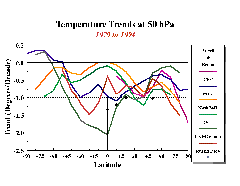
Figure 2.1. Temperature trends in the 50 hPa region assembled from a variety of data sets (table 2.1). These include radiosonde (Angell, Berlin, Oort, Russia and UKMO), satellite (MSU and SSU, which are actually representative of a broad altitude region that spans the lower stratosphere), and Climate Prediction Center (CPC) analyses.
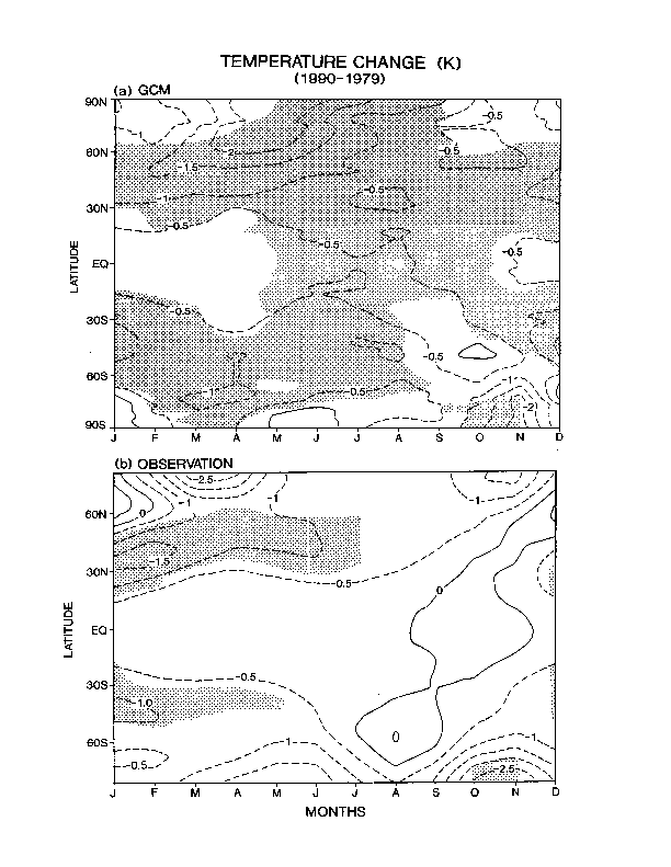
Figure 2.2. (a) GCM simulation of the temperature decrease (K/decade) in the lower stratosphere due to the observed ozone loss. (b) Temperature trend (K/decade) as inferred from the MSU data. (From Randel and Cobb, 1994 and Ramaswamy et al., 1996).
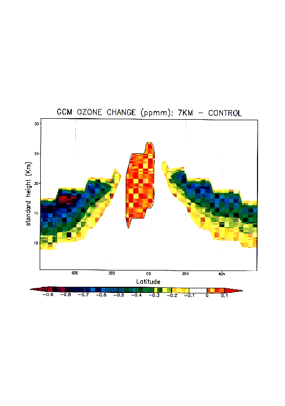
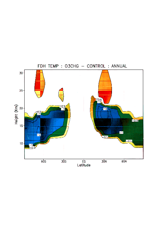
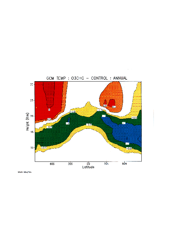
Figure 2.3. Ozone changes, FDH and GCM (GFDL SKYHI model with ~3-degree latitude-longitude resolution) computed temperature changes in the lower stratosphere corresponding to 1979-1991 period (from Ramaswamy and Schwarzkopf, 1996).
4. Southern Hemisphere Antarctic spring shows a strong cooling in the lower stratosphere.
5. Tropical lower stratosphere trends suggest differences between radiosonde and satellite. A possible cause is the different altitude regions that the satellite `senses' relative to the altitude of sampling in the case of radiosondes.
6. Cooling in the lower stratosphere accelerated during the 1979-1994 period compared to the earlier years (based on radiosonde data).
Middle and Upper Stratosphere
7. Strong and statistically significant cooling in the upper stratosphere over virtually the entire domain from ~70°N to 70°S is evident in the SSU satellite data.
8. Biases incurred as a result of changing concentrations of carbon dioxide could affect the inferred upper stratosphere trends; this is currently estimated to be a small effect.
9. In the middle and upper stratosphere, the interpretation of the satellite data is complicated by the discontinuity of the satellite record for this altitude region.
10. There is a qualitative consistency in the trend patterns for the middle and upper stratosphere and the mesosphere from the various data sets, including rocketsonde and lidar in the mid-latitude Northern Hemisphere.
From MODEL RESULTS and MODEL - OBSERVATION comparisons
Lower Stratosphere
1. Ozone loss in the lower stratosphere is a dominant factor in the modelled cooling of this region over the 1979-1994 period. No other known radiative change is estimated to be this large a contributor. There are, however, minor contributions due to increases in the well-mixed greenhouse gases. Also, possible changes in global stratospheric water vapour and in tropospheric ozone could contribute to the observed cooling. The cooling of the lower stratosphere has an important bearing on the detection and attribution of the vertical profile of temperature changes to anthropogenic activities.
2. Ozone-induced lower stratospheric cooling peaks in winter and spring. Modelled dynamical variability peaks in winter, consistent with observations. A strong cooling is seen in observations, but variability is a factor in assessing the statistical significance in both model and observations.
3. Modelled Northern Hemisphere mid-latitude cooling trends are statistically significant both in observations and model simulations.
4. Modelled Southern Hemisphere mid-latitude region also shows a statistically significant cooling.
5. GCMs indicate that the pattern of the global lower stratospheric temperature change attributed to ozone loss is principally a radiative adjustment, but there are important features that point to the role of dynamics in determining the quantitative aspects of the temperature changes (figure 2.3c).
6. The comparison of modelled results with observations necessarily rely on the accuracy of the measured vertical profile of ozone changes in the lower stratosphere that are used as inputs to `drive' the model. Uncertainties in the measured ozone changes and temperature trends in the vicinity of the tropopause inhibit a rigorous geographical comparison of the modelled and observed temperature changes in that region.
7. There is little evidence to suggest that tropospheric dynamical changes or SST changes have been dominant factors in the lower stratospheric cooling over the 1979-1994 period.
Middle and Upper Stratosphere
8. In the upper stratosphere, there is cooling due to well-mixed greenhouse gases and ozone losses, with the contribution by the former increasing with altitude. This is consistent in sign with observations, but there are some uncertainties due to the precise knowledge of ozone changes in the middle stratosphere. These are, however, less significant than the uncertainties near the tropopause (see point #6 above). With regards to observations, the changing of the weighting function owing to changes in CO2, etc. is a factor to be considered.
9. Effects due to increased water vapour in the middle and upper stratosphere could be important; unfortunately, the knowledge of changes in water vapour are not available globally. In the one location where a continuous record exists (viz., Boulder, Colorado, USA) a positive trend in water vapour is found.
10. Model results suggest a warming of the middle and upper stratospheric regions (above the ozone loss layers in the lower stratosphere) in the high latitudes. While there are some hints of this in the southern high latitudes from the SSU satellite data, the large variability in this region inhibits a statistically significant result. Some analysed fields that are based on SSU data indicate a significant warming in the middle and upper stratosphere, but these are probably less reliable than the more directly-inferred "SSU/UKMO/NASH" data set.
11. There is little evidence to suggest that changes in the tropospheric climate have influenced middle or upper stratospheric temperature changes over the 1979-1994 period.
There is a strong need for a continuous temperature trends assessment study, with reports made available at frequent intervals (e.g., every 5 years). This should include updates and quality control of data sets, model-observation comparisons, detection and attribution analyses of the trends and causes, and improved estimates for the future based on scenarios of potential changes in atmospheric composition. Specific points for intensive considerations are listed below. Broadly speaking, these include a systematic analysis of the quality and accuracy of all of the instrumental data, quantitative analyses of the spatial and temporal variations manifest in the observational data, improvements in model simulations and the understanding of `natural' or unforced variability, model responses to changes in composition that occur within the stratosphere and also that in the troposphere (to the extent that they affect the stratosphere), and careful diagnoses of the trends and their attribution using observations and model simulations. These activities would necessarily require a close co-ordination and interactions with other SPARC activities (see other sections of this document), as well as with other appropriate WCRP projects (e.g., CLIVAR). It is also vital to sustain a linkage between temperature trends research and the monitoring of the concentrations of radiatively active species, especially those that are temporally and spatially variable (e.g., ozone, water vapour and aerosols).
Some specifics are highlighted below.
1. A critical component feeding into the Stratospheric Temperature Trends Assessment is the availability of accurate and globally extensive time series. A high accuracy is needed for determining the trends and their statistical significance. There are points of concern about both the ground-based and satellite observations. In particular, the lack of adequate radiosonde coverage over oceanic regions, tropical belts and in the Southern Hemisphere pose limitations for inferring global trends. The rocketsonde data has been under-utilised for trends partially because of the different periods of operation of the instruments at different locations. While rocketsonde observations of the middle stratospheric regions and above could be supplanted by lidar stations, a concern arises about the viability of their long-term monitoring operation and the adequacy of funding levels to maintain them. In this regard, the continuous operation of the Observatoire de Haute Provence station in France should be considered as a role model. As far as satellite data is concerned, there are plans for deploying instruments over the next few years (e.g., EOS, ENVISAT, NPOESS), and ensuring the continuity of the MSU and SSU systems so that there may be no scarcity of data in the future. A concern, nevertheless, with satellite monitoring is the requirement of a continuous knowledge of the accuracy and stability of the instrument. Yet another concern is the extent to which the data from successive generations of satellites can be put together in an appropriate fashion and be interpreted correctly for purposes of estimating the variability, and for determining the trends and their statistical significance. A potential for long-term surveillance of temperatures with a high resolution and accuracy is offered by the Global Positioning System (GPS). It is recommended that the principle of the GPS operation and its deployment in a practical sense for inferring stratospheric temperatures be considered seriously.
2. With the availability and now assemblage of time series from several sources, it is necessary to maintain an appropriate "SPARC data archive" such that the existing data can be utilised in a general sense and that data available in the future can be added to the archive with relative ease.
3. Analyse the discrepancies prevailing between different sources of the instrumental data and ascertain their cause/s. Analyse the causes of differences in the temperature trend results derived from data sets that conduct some form of analyses or that combine observations from more than one type of instrument. Corrections to the radiosonde data (which are being performed at some institutions) should be incorporated and revised trend estimates made. The rocket data for the middle and upper stratosphere has been under-exploited and deserves to be compared with the recently available lidar and satellite data. Examine time series from the various data sources and the resulting trends at individual geographical locations.
4. Characterise the variability on different scales - timescales ranging from monthly to seasonal to annual to interannual to decadal, and spatial scales ranging from individual locations to regional areas to zonal belts to planetary dimensions. Further work is needed on understanding and modelling the effects of variations due to solar irradiance changes, volcanic eruptions and the QBO in order to improve upon the estimates of "natural" variability, trends detection and their attribution to anthropogenic causes.
5. Model experiments are needed to explore further the dynamical effects (whether originating from within the stratosphere or from the troposphere) influencing the temperature structure of the stratosphere e.g., response to greenhouse gas increases which lead to a change in the tropospheric equator-to-pole heating gradient and planetary wave propagation, and could thereby alter the dynamical heating in the stratosphere. Such studies should continue to make comparisons with appropriate diagnostics of up-to-date observations so that the influences due to dynamics can be better quantified.
6. An important requirement for the accurate evaluation of model-observations comparisons is high precision monitoring of the quantitative changes occurring in various radiatively-active species whose perturbation of the temperature field is to be analysed. This need exists in particular for ozone, water vapour and aerosols in the lower stratosphere/upper troposphere regions. For water vapour, monitoring strategies need to improve considerably in order to provide information on trends in the upper troposphere and lower stratosphere.
7. Detailed model simulations and analyses are needed to confirm whether the changes observed in the upper and middle stratosphere and mesosphere from recent data sets are consistent with the known changes in species (primarily, the well-mixed greenhouse gases) and present radiative-dynamical-chemical knowledge. This situation is somewhat different from that prevailing for the lower stratosphere where, despite quantitative uncertainties, there is unambiguous identification of the cooling as being due principally to ozone losses.
8. Given the fact that the time series of stratospheric temperatures is now available from a variety of platforms (tables 2.1 and 2.2), and in a continuous manner over the global domain from 1979 onwards with adequate spatial coverage back to ~1960s, it is of considerable interest to perform equilibrium and transient GCM simulations with varied assumptions about forcings. This would enable a broad-based understanding of the sensitivity of the stratospheric-mesospheric system to various known factors. Considerations for the model simulations could include no forcing at all, forcing from entirely the tropospheric variability (e.g., sea-surface temperature), forcing due to changes in the well-mixed greenhouse gases, forcing due to observed changes in ozone, forcing due to water vapour changes, forcing due to the known aerosol loading from volcanic eruptions, and forcing due to "natural" factors (e.g., solar variations, QBO). The specification of the spatial and temporal evolution of the forcing magnitudes would necessarily rely on long-term, continuous monitoring efforts. Some of the forcings could also be obtained from explicit modelling of the interactions involving emissions of compounds, and the chemical, transport and removal processes. Results from a series of such simulations, performed using models of adequate horizontal and vertical resolution, could be then compared with the observed time series. These comparisons would yield insights into the variability and changes in stratospheric and mesospheric temperatures on different spatial and temporal scales, and thus pave the way for more robust attribution of the observed changes to specific causal factors. As examples, the GCM studies conducted by Santer et al. (1996), Ramaswamy et al. (1996), Tett et al. (1997) and Hansen et al. (1997) have begun yielding extremely useful insights about the likely causes of changes in the lower stratosphere and troposphere. This type of modelling activity will lead to increased confidence in the detection and attribution of anthropogenic influences on the vertical profile of temperature change in the atmosphere. This is an important objective of WCRP.
A corollary to the above line of study is to model the evolution of stratospheric temperatures over the next few decades for specific scenarios (e.g., the anticipated slowdown of the ozone losses and the turnaround in their concentrations), and then compare the model-predicted temperature evolution with that observed.
9. Since the temperature changes in the stratosphere can be a significant factor in the forcing of the surface-troposphere system (WMO, 1994), the temperature variability and trends analyses can profitably be used to determine the surface-troposphere radiative forcing. This could be done using either models or observations by themselves, or some relevant combination/s. Of particular interest is the forcing due to radiatively active species in the stratosphere that have a spatial and temporal variation. A follow-up to this would be an investigation of the response of the surface-troposphere climate system to the forcings originating near the tropopause and the stratosphere (e.g., ozone, water vapour) as in Hansen et al., 1997.
Angell, J., Variations and trends in tropospheric and stratospheric global temperatures, J. Climate, 1, 1296-1313, 1988.
Bailey, M. J., A. O'Neill and V. D. Pope, Stratospheric analyses produced by the United Kingdom Meteorological Office, J. Appl. Meteor., 32, 9, 1572-1483, 1993.
Finger, F. G., M. E. Gelman, J. D. Wild, M-L. Chanin, A. Hauchecorne and A. J. Miller, Evaluation of NMC upper stratospheric analyses using rocketsonde and lidar data, Bull. Amer. Met. Soc., 74, 5, 789-799, 1993.
Fortuin, P. J. F., and H. Kelder, Possible Links between Ozone and Temperature Profiles. Geophysical Research Letters, Vol. 23, No. 12, pp 1517-1520. 1996.
Gelman, M. E., A. J. Miller, R. N. Nagatani and C. S. Long, Use of UARS data in the NOAA stratospheric monitoring program, Adv. Space Res. , 14, 9(21) - 9(31), 1994.
Gelman, M. E. et al., Stratospheric temperature trends derived from SPARC data sets, Proceedings, First SPARC General Assembly, Melbourne, pp 153-156, 1996.
Golitsyn, G. S. et al., Long-term temperature trends in the middle and upper atmosphere, Geophys. Res. Lett., 23, 1741-1744, 1996.
Golitsyn, G.S., A.I. Semenov, N.N. Shefov, L.M. Fishkova, E.V. Lysenko, and S.P. Perov, Long-term Temperature Trends in the Middle and Upper Atmosphere. Geophysical Research Letter, Vol. 23, No. 14, pp 1741-1744. 1996.
Hansen, J. E. et al., Satellite and surface temperature data at odds? Clim. Change, 30, 103-117, 1995.
Hansen, J. E., M. Sato and R. Ruedy, Radiative forcing and climate response, J. Geophys. Res., 102, 6831-6864, 1997a.
Hauchecorne, A., M-L. Chanin and P. Keckhut, Climatology and trends of the middle atmospheric temperature (33-87 km.) as seen by Rayleigh lidar over the south of France, J. Geophys. Res., 96, 15297-15309, 1991.
Kalnay, E. et al., The NCEP/NCAR 40-year reanalysis project, Bull. Amer. Met. Soc., 77, 3, 437-471, 1996.
Keckhut, P., A. Hauchecorne and M.L. Chanin, Midlatitude long-term variability of the middle atmosphere: Trends and cyclic and episodic changes, J. Geophys. Res., 100, 18887-18897, 1995.
Keckhut, P., F.J. Schmidlin, A. Hauchecorne, and M.-L. Chanin,
Detection of Trends in the Middle Atmosphere as seen by US Rocketsonde Stations of the Northern Low Latitudes (9-34°N) and Taking into Account Instrumental Changes. To be submitted to Journal of Atmospheric and Terrestrial Physics. 1998.
Komuro, H., Long-term Cooling in the Stratosphere Observed by Aerological Rockets at Ryori, Japan. Meteorological Society of Japan, pp 1081-1082. 1989.
Koshelkov, Yu. P. and G. R. Zakharov, On temperature trends in the Arctic lower stratosphere, Meteorologia i Gidrologia, in press, 1997.
Labitzke, K. and H. van Loon, Trends of temperature and geopotential height between 100 and 10 hPa in the Northern Hemisphere, J. Meteor. Soc. of Japan, 72, 5, 643-652, 1994.
Labitzke, K., and H. van Loon, A Note on the Distribution of Trends below 10hPa: The Extratropical Northern Hemisphere. Journal of the Meteorological Society of Japan, Vol. 73, No. 5, pp 883-889. 1995.
Lübken, F.-J., K.H. Fricke and M. Langer, Noctilucent Clouds and the Thermal Structure Near the Arctic Mesopause in Summer. Journal of Geophysical Research, Vol. 101, pp 9489-9508. 1996.
Lysenko E.V., G.G. Nelidova, and A.M. Prostova, Changes in the Stratospheric and Mesospheric Thermal Conditions during the Last Three Decades: 1. The Evolution of a Temperature Trend. Izvestiya, Atmospheric and Oceanic Physics, Vol. 33, No. 2, pp 218-225. 1997.
Nash, J. and G. F. Forrester, Long-term monitoring of stratospheric temperature trends using radiance measurements obtained by the TIROS-N series of NOAA spacecraft, Adv. Space Res., 6, 10, 37-44, 1986.
Oort, A. H. and H. Liu, Upper-air temperature trends over the globe 1958-1989, J. Climate, 6, 292-307, 1993.
Parker, D. E. and D. I. Cox, Towards a consistent global climatological rawinsonde data base, Int. J. Climatol., 15, 473-496, 1995.
Schubert, S. R., R. Rood and J. Pfaendtner, An assimilated data set for earth science applications, Bull. Amer. Met. Soc., 74, 2331-2342, 1993.
Spencer, R. W. and J. R. Christy, Precision lower stratospheric temperature monitoring with the MSU technique, validation and results 1979-1991, J. Climate, 6, 1194-1204, 1993.
Parker, D. E., On the detection of temperature changes induced by increasing atmospheric carbon dioxide, Quart. J. R. Met. Soc., 111, 587-601, 1985.
Ramaswamy, V. and M. D. Schwarzkopf, Stratospheric temperature trends: observations and model simulations, Proceedings, First SPARC General Assembly, Melbourne, pp 149-152, 1996.
Ramaswamy, V., M. D. Schwarzkopf and W. Randel, 1996: Fingerprint of ozone depletion in the spatial and temporal pattern of recent lower-stratospheric cooling. Nature, 382, 616-618.
Santer, B. D. et al., A search for human influences on the thermal structure of the atmosphere. Nature, 382, 39-46. 1996.
Randel, W.J., and J.B. Cobb, Coherent variations of monthly mean total ozone and lower stratospheric temperature. J. Geophys. Res., 99, 5433-5447. 1994.
Santer, B. et al., A search for human influences on the thermal structure of the atmosphere, Nature, 382, 39-46, 1996.
Swinbank, R., and A. O'Neill, A stratosphere-troposphere data assimilation system. Monthly Weather Review, 122, 686-702. 1994.
Tett, S. F. B., J. F. B. Mitchell, D. E. Parker and M. R. Allen, Human influence on the atmospheric vertical temperature structure: detection and observations, Science, 274, 1170-1173, 1996.
World Meteorological Organisation, Report of the International Ozone Trends Panel, Geneva, Report No. 18, 1988.
World Meteorological Organisation, Scientific assessment of ozone depletion, Global Ozone Research and Monitoring Project, report No. 37, Geneva, 1994.
Large efforts have been made to detect trends in temperature and ozone. In order to understand the spatial and seasonal characteristics of these trends, the knowledge of trends in dynamical activity is essential. Dynamical trends in the stratosphere have two aspects. First, there may be trends induced by changes in concentrations of radiatively active gases, namely an increase in the amount of carbon dioxide and a decrease in the amount of ozone. Secondly, trends in the stratosphere resulting from any trends in the troposphere. A key challenge will be to determine whether any observed trends can be attributed to either or both of these.
Trends in stratospheric ozone concentration and temperature are expected to reflect the direct influence of the increasing concentrations of CO2 and/or CFCs. However the trends detected sometimes present a complex spatial and seasonal structure. For example, although large decreasing trends in total ozone and temperature are found over Eurasia, increasing trends also exist above Greenland (Randel and Cobb, 1994). At the north pole, cooling trends of the middle stratosphere are found during the autumn to early winter, which are replaced by warming trends during the late winter to spring (figure 2.4a) (Labitzke and van Loon, 1994). Such a spatial and seasonal structure of trends can be understood only from a dynamical point of view.
Relatively small changes in radiative forcing can have large effects on the dynamics of the winter stratosphere through interaction between the planetary waves and zonal-mean zonal wind (e.g., Fels, 1987). It should also be noted that, not only do tropospheric perturbations propagate upward into the stratosphere, but through wave mean-flow interaction, changes produced in the stratosphere can propagate downward into the troposphere (Boville, 1984; Kodera et al., 1996). General circulation model experiments suggest that polar ozone depletion may have an impact on dynamical processes, such as a strengthening of the polar night jet in the lower stratosphere and a delaying of final stratospheric warmings (Mahlman et. al, 1994; Langematz, 1995; Shindell et al., 1997; Zhao et al., 1996).
To date, not many studies have been conducted to detect trends in dynamical activity. Here, we briefly review a few reported trends and examine how compatible they are with each other in order to define future work needed to answer the scientific objectives of SPARC. Since there are large differences between the atmospheric circulation in the northern and southern hemisphere, in the following, trends in zonal-mean zonal winds and planetary waves are described separately for each hemisphere.
* Zonal-mean zonal wind
A strengthening of the polar night jet has been reported for the period 1979-1991 by Kodera and Yamazaki (1994). Trends in geostrophic winds are also found over the longer period, from 1958-1992, as a decreasing and increasing trend in the 50 hPa geopotential height at high latitudes and mid-latitudes, respectively (Perlwitz and Graf, 1995). The trends in the zonal-mean zonal wind have an interseasonal structure which has been studied using Free University of Berlin (FUB) geopotential data from 1966-1993 (Kodera and Koide, 1997). Increasing trends in zonal-mean zonal wind are found during the early winter in the stratosphere. The region of increasing trend descends during the winter, giving way, at the end of the winter, to decreasing trends in the upper stratosphere (figure 2.4b).
* Sudden warmings
According to Labitzke and van Loon (1992), 17 major warmings have occurred during the 41 years from 1951 to 1991 giving, on average, a frequency of one major warming every 2.4 years. Before 1992 the largest lapse of time between two major warmings was 4 years, however, no major warming has occurred during the 6 winters since 1992. Is this an indicator of anthropogenic change?
* Planetary waves
A decreasing trend in the amplitude of zonal wave number 1 has been reported in the January mean geopotential height in the lower stratosphere, in relation to the spatial structure of trends in total ozone measured with TOMS (Hood and Zaff, 1995; Mc Cormack and Hood, 1997). This decrease in wave amplitude can be traced down into the troposphere. A similar analysis of trends in zonal asymmetric components of total ozone (Peters et al., 1996) also shows a relationship with changes in tropospheric stationary waves. A decrease in stationary wave activity between the early 80s (1979-1981) and early 90s (1988-1990) is also found in the November Eliassen-Palm (E-P) flux cross-section (Kodera and Yamazaki, 1994). These observations are based on satellite data started after 1979. On the other hand, a study (Naujokat et al., 1997) using daily subjective analysis of FUB data suggests an increasing trend in the daily amplitude of height wave 1 at 60N, 30 hPa for the longer period 1965-1995.
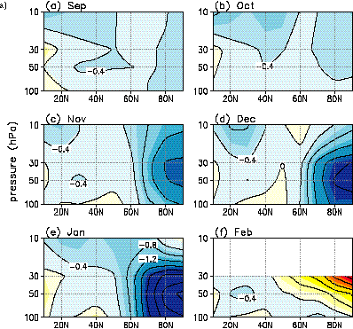
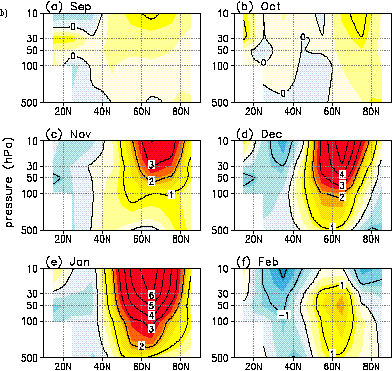
Figure 2.4 a) Trends in zonally-averaged monthly mean temperature (K/decade) for 1965-1993. (After Labitzke and van Loon, 1994)
b) Trends in zonally averaged monthly mean zonal wind (m/s/decade) for 1966-1993 (Kodera and Koide, 1996)
* Zonal-mean zonal wind
In the southern hemisphere, because of the lack of long-term observations, no clear trend in zonal-mean zonal winds has been reported. Although Kawahira and Hirooka (1992) tried to get some information by taking the difference between the circulation during winter 1987 and the CIRA reference atmosphere model, their results, based on particular years, may not be representative as long term trends. On the other hand, their results based on the NCEP (former NMC) data for the shorter period 1980-1988 shows a decreasing trend in the westerly jet in the upper stratosphere during September. The meridional cross section of trends in zonal-mean zonal winds calculated from NCEP data for the period 1979-1994, shows an increasing trend in the polar region but a decreasing trend elsewhere, which form an inclined dipole type pattern in the stratosphere (figure 2.5a).
Based on the same NCEP data, interannual variability of the seasonal evolution in the zonal-mean zonal wind from autumn to spring has been studied using multiple empirical orthogonal function (EOF) analysis. Spatial structure of the EOF 1 shows development of a dipole pattern during the winter and poleward and downward shift during the spring. The spatial pattern of the EOF 1 in September is similar to that found in the trend in figure 2.5a. In fact, time coefficients of the EOF 1 exhibit a clear linear trend superposed on the quasi-biennial (QB) variation (figure 2.6a solid line) (Kuroda et al., 1997).
* Stratospheric warming
Although the results of analysis by Randel (1988) suggest a delay of final warming due to large depletion of ozone in 1987, no clear trend in the date of the final warming was found in the more recent analysis by Yamaguchi and Hirooka (1996) based on the longer period of data from 1980-1992. In their analysis (figure 2.6b), two different criteria were used to define the date of the final warming; the reversal of temperature and the reversal of zonal wind at the 10 hPa. Using the zonal wind definition some tendency of delay in the final warming after the year 1987 is suggested except for the winters 1988 and 1989. However, when the warming is defined by its temperature reversal, only the QB variation is apparent.
* Planetary waves
An interannual variation in planetary scale wave structure has been observed over the period 1979-1992 in the total ozone column measured by TOMS (Bodeker and Scourfield, 1995, Kawahira, 1997). An increasing trend in the wave amplitude is discernible superposed on a large quasi-biennial variation (figure 2.6c). An increasing trend in wave activity during the winter in the lower stratosphere as well as in the troposphere is also detected by applying an EOF analysis on the vertical component of Eliassen-Palm flux (figure 2.6a dashed line).
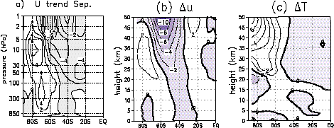
Figure 2.5. a) Observed trend in zonal-mean zonal winds (m/s/decade) in September for 1979-1994.
b) Difference in zonal-mean zonal winds (m/s) in September between the ozone hole simulations and control runs (Langematz, 1995). c) Same as in b) but for the temperature difference (K).
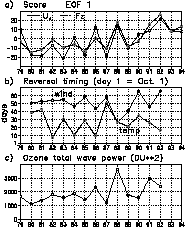
Figure 2.6. a) Time coefficients of the multiple month EOF 1 of the zonal-mean zonal wind (solid line), and vertical component of E-P flux (dashed line) during May.-Oct. (After Kuroda et al., 1997). b) Time series of the date of final warming in the Southern Hemisphere defined by reversal of zonal winds (solid line) and temperature (dashed line). Day 1 corresponds to the 1st October. (after Yamaguchi and Hirooka, 1996). c) Time series of the ozone wave power averaged over Antarctic vortex period from 19 Jul. to 1 Dec. (After Bodeker and Scourfield, 1994).
In the northern hemisphere, increasing trends in zonal winds and weakening trends in planetary wave activity seem consistent for the period 1979-1990. The decreasing occurrences of midwinter sudden warmings in recent years are also consistent with the strengthening of the polar night jet and weakening of wave activity. However, the meaning of the increasing trend in the daily amplitude of height wave 1 for longer period is not very clear. Does this mean that there is an increase in the transient wave amplitude but decrease in the stationary wave? Does the increasing trend originate from the troposphere or it can only be seen in the stratosphere? More comprehensive studies in changes in wave activity are needed to answer these questions.
The downward shift of the regions of the increasing trend in zonal-mean zonal winds during the winter corresponds to the appearance of the warming trends in temperature (figure 2.4). These overall features of trends in dynamical activity during the winter could be interpreted as trends in the occurrence frequency of an internal mode of variability in the winter stratosphere and troposphere. Further identification of this mode is needed.
Another major problem in the northern hemisphere is to determine the causal relationships between the trends in the stratospheric zonal winds and tropospheric waves. If the observed trends are real, the following two possibilities may be investigated:
1) Warming trends in the troposphere cause changes in tropospheric planetary waves, which produces changes in the stratosphere.
2) Cooling trends in the polar stratosphere and/or warming trends in the subtropics of the upper troposphere trigger a stronger polar night jet by modifying planetary wave structure.
These two scenarios are not exclusive to each other, and combined effects should also be considered.
Rind et al. (1990) looked at the stratospheric response to CO2 doubling and found that there was an increase in stratospheric planetary waves. He attributed the increase to the enhanced planetary wave propagation due to smaller static stability in the lower stratosphere/upper troposphere. This is not at all obvious. For instance CO2 doubling should decrease the meridional tropospheric temperature gradient which should mean smaller winds which should mean less orographic forcing of planetary waves. On the other hand, a smaller surface wind implies a larger thermal forcing of planetary waves (Geller, 1992). Deciding what will actually happen is not easy. Model/observational comparison seems to be the only way.
Recently, during the 1990s, there has been a tendency in the northern hemisphere for the strong cold polar vortex to persist until March. It should be emphasised that this cooling trend is only apparent very recently and that data over a longer period from 1964-1993 suggest rather a warming trend in March (Labitzke and van Loon, 1994). In this respect, it is worth noting that a model experiment (Zhao et al. 1996) suggests the possibility that large ozone destruction can produce a strong polar vortex in March. It may also be necessary to separately investigate trends during autumn-winter and winter to spring, where chemical impacts may not be the same.
In the southern hemisphere decreasing trends in zonal wind are found at mid- and low latitudes and an increasing trend in the polar region. The region of decreasing trends expands poleward during Spring. An increasing trend in wave activity is also suggested during the winter (figure 2.6c). When we look at only the QB variability in figure 2.6b, earlier dates of final warmings correspond to the winters of larger planetary wave amplitudes and weaker stratospheric jet, which is quite understandable. On the other hand, the suggested delaying trends in final warmings may be difficult to understand from the atmospheric conditions of enhanced wave activity and decreasing zonal winds in a large part of the stratosphere during October. It is quite interesting, however, that a General Circulation Model (GCM) simulation of the ozone hole (Langematz, 1995) suggests that depletion of ozone in the lower stratosphere can produce not only the delay of final warming in late spring, but also already in September a large decrease in the westerly jet in the upper stratosphere and a warming of the polar stratopause (figure 2.5b and 2.5c). It is interesting to note the similarity between the observed trends in September (figure 2.5a). The similarity in spatial structure does not necessarily mean that the origin is the same, but it suggests that the dynamical processes responsible for such a spatial pattern are similar.
The delaying trend in the observed date of the final warming seems to be negligibly small and is probably not significant. Also, caution is needed when comparing model results. Since the atmospheric dynamical processes are highly non-linear, model responses to the same perturbation can be quite different if the model climatology is different. The dynamical impact of the ozone hole was found to be weaker in the GFDL experiment (Mahlman et. al, 1994) than in the FUB experiment (Langematz, 1995). This difference could be a consequence of the stronger climatological polar vortex in the GFDL model. In the GISS experiment (Shindell et al., 1997), mountain drag has been reduced in order to obtain more realistic basic state in the polar lower stratosphere. Their results of ozone hole simulations indicate a very active and complex dynamical interaction.
In order to conduct an investigation on the trends in dynamics, global grid data are very useful. In this respect, recent progress in reanalysis projects is very beneficial. It should be noted however that although the data analysis method may be identical for all the period covered, the spatial coverage of data and data sources have changed with the time. Therefore, it is necessary to examine how reanalysed data can be extended for trend analysis prior to 1979, before when no operational satellite data are available. It should also be noted that currently available reanalysed data cover only up to 10 hPa. However, the winter atmospheric circulation is strongly connected from the surface to the mesosphere. For the understanding of the trends in the lower stratosphere, data covering from the surface to, at least, the stratopause are desirable.
Because the stratosphere is dynamically coupled with the troposphere, if we want to identify the origin of long-term changes in the stratosphere-troposphere system, we also need to study changes in ocean and land surface processes. So that, strong interaction and co-operation with other climate study projects such as CLIVAR and GEWEX become indispensable.
Bodeker, G. E., and M. W. J. Scourfield, Planetary waves in total ozone and their relation to Antarctic ozone depletion, Geophys. Res. Lett., 22, 2949-2952, 1995.
Boville, B. A., The influence of the polar night jet on the tropospheric circulation in a GCM, J. Atmos. Sci., 41, 1132-1142, 1984.
Fels, S. B., Response of the middle atmosphere to changing O3 and CO2, A speculative tutorial, in Transport processes in the middle atmosphere, G. Visconti and R. Garcia eds., pp. 371-386, Reidel, Dordrecht, Holland, 1987.
Geller, M. A., Planetary wave coupling - observations and theory, in Coupling processes in the lower and middle atmosphere, E. V. Thrane, T. A. Blix and D. C. Fritts eds., pp. 95-121, Kluwer Academic Publ., Dordrecht, Netherlands, 1992.
Hood, L. L., and D. A. Zaff, Lower stratospheric stationary waves and the longitude dependence of ozone trends in winter, J. Geophys. Res., 100, 25791-25800, 1995.
Kawahira, K., and T. Hirooka, Variations of mean zonal winds relating to the ozone hole, J. Geophys. Res., 97, 10157-10163, 1992.
Kawahira, K., Recent development and the horizontal structure changes in the Antarctic ozone hole, in Proceedings of the first SPARC general assembly: Vol II, WMO/ TD-NO.814, 614-617, 1997.
Kodera, K., M. Chiba, H. Koide, A. Kitoh, and Y. Nikaidou, Interannual variability of the winter stratosphere and troposphere in the Northern Hemisphere, J. Meteorol. Soc. Jpn., 74, 365-382, 1996.
Kodera., K and H. Koide, Spatial and seasonal characteristics of recent decadal trends in the Northern-Hemispheric troposphere and stratosphere, J. Geophys. Res., 102, 19433-19447, 1997.
Kodera, K., and K. Yamazaki, A possible influence of recent polar stratospheric coolings on the troposphere in the northern hemisphere winter, Geophys. Res. Lett., 21, 809-812, 1994.
Kuroda, Y., K. Kodera, K. Yamazaki, Poleward jet shift in the Southern Hemisphere, in Proceedings of the first SPARC general assembly: Vol I, WMO/ TD-NO.814, 55-58, 1997.
Labitzke, K., and H. van Loon, On the association between the QBO and the extratropical stratosphere, J. Atmos. Terr. Phys., 54, 1453-1463, 1992.
Labitzke, K., and H. van Loon, Trends of temperature and geopotential height between 100 and 10 hPa on the Northern Hemisphere. J. Meteorol. Soc. Jpn, 72, 643-652, 1994.
Langematz U., Sensitivity of the Berlin TSM-GCM climatology to changes in Antarctic ozone, paper presented at IUGG XXI General Assembly, Boulder, 1995.
Mahlman, J. D., J. P. Pinot, and L. J. Umscheid, Transport, radiative, and dynamical effects of the Antarctic ozone hole, J. Atmos. Sci., 51, 498-508, 1994.
Mc Cormack, J. P., and L. L. Hood, Modeling the spatial distribution of total ozone in northern hemisphere winter 1979-1991/ J. Geophys. Res., 102, 13711-13717, 1997.
Naujokat, B., S. Pawson, and A. Piel, Is there a trend in the occurrence of extremely low temperature in the northern stratospheric winter?, in Proceedings of the first SPARC general assembly: Vol I, WMO/ TD-NO.814, 157-160, 1997.
Perlwitz, J., and H-F. Graf, The statistical connection between tropospheric and stratospheric circulation of the Northern Hemisphere in winter, J. Clim., 8, 2281-2295, 1995.
Peters, D., G. Entzian, and G. Schmitz, Ozone anomalies over the north Atlantic-European region during January 1979-1992, Linear modeling of horizontal and vertical ozone transport by ultra-long waves, Beitr. Phys. Atmos., 69, 477-489, 1996.
Randel, W. J., The anomalous circulation in the Southern Hemisphere Stratosphere during spring 1987, Geophys. Res. Lett., 15, 911-944, 1988.
Randel, W. J., and J. B. Cobb, Coherent variations of monthly mean total ozone and lower stratospheric temperature, J. Geophys. Res., 99, 5433-5447, 1994.
Rind, D., R. Suozzo, N. K. Balachandran, and M. J. Prather, Climate change and the middle atmosphere. Part I: The doubled CO2 climate, J. Atmos Sci., 47, 475-494, 1990.
Shindell, D. T., S. Wong, and D. Rind, Interannual variability of the antarctic ozone hole in a GCM. Part I: The influence of tropospheric wave variability, J. Atmos. Sci., 54, 2308-2319, 1997.
Yamaguchi, T., and T. Hirooka, Relationship between the depth of ozone hole and southern hemispheric stratospheric final warming, paper presented in autumn meeting of Japan Meteorol. Soc., C110, (in Japanese), 1996.
Zhao, X., R. P. Turco, C.-Y. J. Kao, and S. Elliott, Numerical simulation of the dynamical response of the arctic vortex to aerosol-associated chemical perturbations in the lower stratosphere, Geophys. Res. Lett., 23, 1525-1528, 1996.
To date, assessments of trends in the vertical distribution of ozone and in stratospheric temperature have been carried out by SPARC, as well as modelling activities aimed at the interpretation of the observed trend in temperature. The thermal structure of the stratosphere has suffered the consequences of the increase in anthropogenic greenhouse gases, and changes in the concentration of stratospheric ozone have already been shown to have a measurable influence on stratospheric temperature and more generally on the radiative forcing of the troposphere-stratosphere region. At this time the observed cooling of the stratosphere is mostly a result of ozone depletion; however, it should be noted that the relative roles of ozone depletion and of increases of greenhouse gases on changes in the atmospheric temperature profile are expected to change with time.
Future work will aim at ensuring the high quality and continuity of ozone and temperature measurements in order to be able to continue monitoring stratospheric change. Understanding of temperature trends will be tested through modelling studies. A future assessment of measurements of the water vapour distribution and trends in its concentration will enable specific recommendations to be made for future measurements of this important greenhouse gas.
Current research on trends in dynamical activity will be followed with interest with a view to understanding the importance of trends in transport and dynamical activity on the role of the stratosphere in climate change, as will research on the role of stratospheric aerosol on climate initiated by IGAC.
![]()