Thank you for visiting!
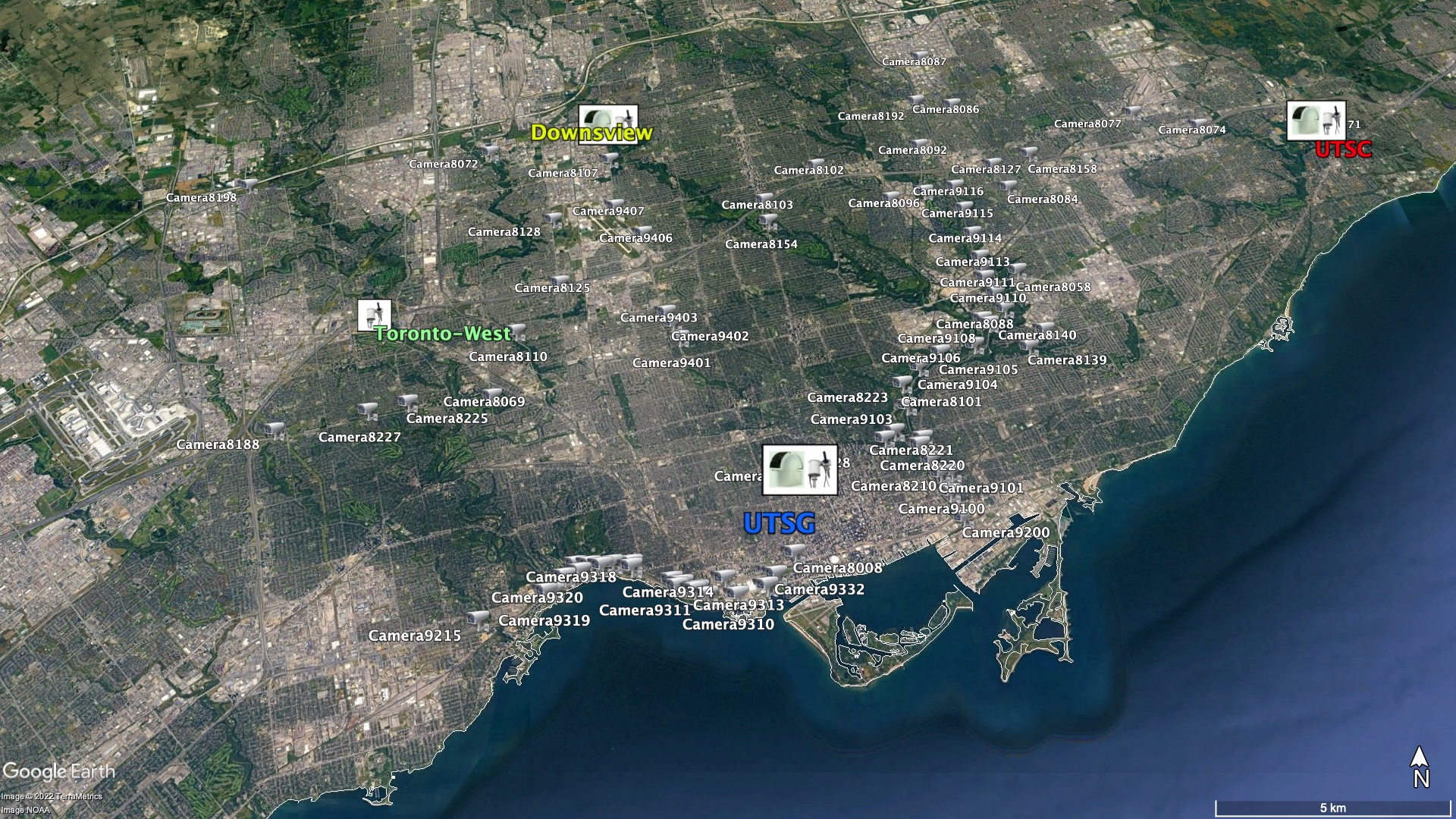
These are the most recent 1 pm images from traffic cameras around the City of Toronto. The images come from Toronto's OpenData portal. The locations of the cameras are shown on the map below the camera images. We are using these images to quantify the timing and growth of trees and other green spaces in our very green city! This project is conducted in collaboration with Environment and Climate Change Canada.
Please visit my home page for other information about my research.
Back to the GTA Emissions webpage
Here's a map of the locations of the traffic cameras: