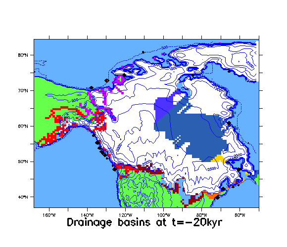
This short movie shows the evolution of drainage basins and topography during the deglacial period. Drainage basins are indicate by different colours (eg. orange drains into the Hudson river outlet, yellow into the St. Lawrence basin, ...). Stranded drainage areas indicate drainage into inland lake. Deepwater drainage outlets are indicated by black and red diamonds, with red diamonds indicating the largest discharges. The drainage algorithm uses 100 year time-steps and computes inland water storage. Proglacial lakes are indicated when grid-cell water storage exceeds mean grid-cell topography.
Only a stub Greenland Ice Sheet is included to allow glaciation between Ellesmere and Greenland. The U of T 3D thermo-mechanically coupled model includes till deformation, visco-elastic bedrock deformation, and physically based parameterizations for surface mass-balance and ice calving. Ice margins are constrained to fit the chronology of Dyke et al (2003).
Note: on some browsers, the movie freezes. If the image is frozen, you can access the direct link to the movie, save it to a local file, and access the movie off your own machine (Not sure why this is, but with Netscape 4.78 for instance, the movie doesn't play off the server but does play off my local machine.)