Previous: Introduction Next: Results Up: Ext. Abst.
2. Characteristics of ILAS Measurements
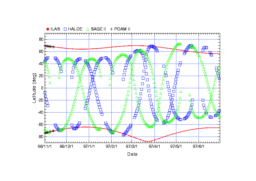
The orbit of the ADEOS is a sun-synchronized polar orbit at 10:30 LT. This orbit enabled solar-occultation ILAS measurements to achieve continuous coverage of high latitudes (57-73N and 64-88S) throughout the year. Figure 1 shows latitudinal coverage of ILAS during its operation period with a few other atmospheric satellite sensors like HALOE, SAGE II, and POAM II. It can be seen that only ILAS could cover the high latitude regions throughout the year. This is an advantage to monitor high-latitude ozone-related chemistry from winter to spring continuously.
Fig. 1. Latitudinal coverage of several satellite sensors
Figure 2 (a) and (b) shows the location of ILAS occultation measurements mapped on potential vorticity map at 475 K potential temperature surface on February 15, 1997 (a) and on May 11, 1997 (b) for the Northern Hemisphere. In Figure 2 (a), it can be seen that ILAS measured both inside and outside the polar vortex in a day even it covers very narrow geographical latitude area due to the oval shape of the polar vortex. Therefore, when we introduce use the equivalent latitude coordinate, ILAS measurements can cover relatively wide (equivalent-) latitudinal area due to the oval shape of the polar vortex.
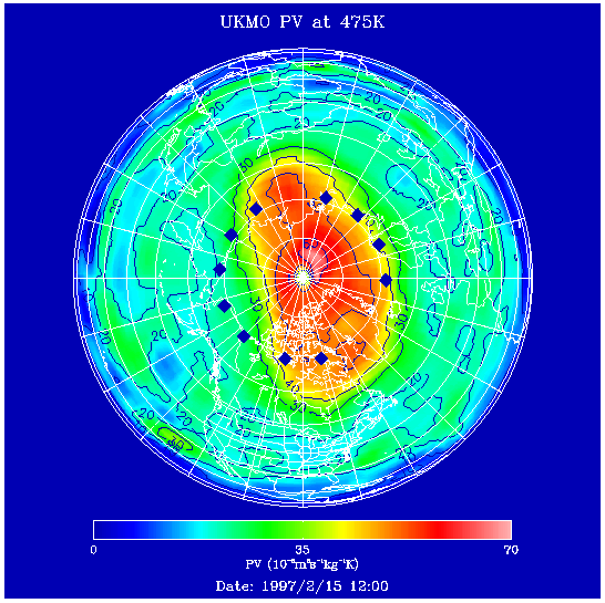
Fig. 2 (a). ILAS measurement locations (blue diamonds) mapped on potential vorticity map at 475 K on February 15, 1997.
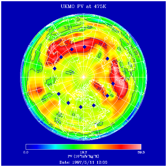
Fig. 2 (b). Same as Figure 2 (a) but for February 15, 1997.