European Space Agency, ESRIN - Via Galileo Galilei, CP 64 Frascati
00044 (Italy)
T: +390694180408, Fax: +390694180402, Email: eoriol@esa.int
FIGURE
Abstract
The European Space Agency’s mandate include to undertake research, development and demonstration of Earth Observation related space technologies. The MetOp satellites, which prototype is planned for 2003, will be the European contribution to the world meteorological polar satellite system, replacing the "morning" satellites, provided by the U.S. at present. MetOp will embark a NOAA payload, plus European advanced instruments. The satellites are being developed by ESA in co-operation with EUMETSAT, which has the overall responsibility of the European Polar System EPS, which main objectives are to furnish data for operational meteorology and climate monitoring. Some instruments on MetOP will provide detailed information on the atmospheric temperature/humidity profiles, essential for weather forecasting. Other parameters will be available from the scatterometer and the global ozone instrument, continuation of the ERS series. The use of MetOp data is expected to contribute to the improvement of meteorological and other applications, plus to Earth Sciences research. Industrial activities for the manufacturing of the satellites started in February 1998, under the leadership of MMS (F).
Keywords: meteorology, climatology, remote sensing, satellites
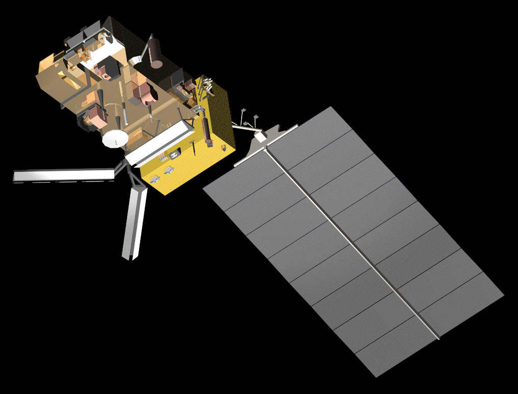
Artist’s view of Met-Op satellite
1. Introduction
The Directorate of Applications of the European Space Agency (ESA) has, among others, the objective of making a contribution from the space to the monitoring and study of the environment (i.e. pollution, climate), Earth resources (renewable and non-renewable) management and monitoring, operational meteorology and solid earth/geophysics. ESA achieved experience in geostationary meteorological satellites (Meteosat), after a first launch in 1977. Similarly, ESA was successful in the development and operations of polar remote sensing satellites ERS (1991, 1995) embarking mainly active radar instruments. The current programs have as main elements: ERS, Envisat, MSG, MetOp and Earth Watch/Explorers. Envisat-1, MSG-1 and MetOp-1 are currently under implementation phase (C/D).
2. Historical background
During the eighties, ESA had been planning to build an Earth Observation multi-disciplinary Polar Platform for flying by the end of the century. At some stage, it was decided that the instruments of meteorological operational nature would be better put together in a separate satellite, based on the polar platform design. Such satellite/s, called MetOp, would be the European contribution to the World’s Meteorological Organization (WMO) satellite system, as replacement of the morning meteorological polar satellites provided now by the USA (NOAA/TIROS series). In order to provide continuity and complementarity, the NOAA payload would also be flown in such satellite.
The remaining instruments, geared mainly to non-meteorological applications, were then put together in the multi-mission Envisat satellite, to be launched in the mid of year 2001.
The European Organization for the exploitation of Meteorological operational Satellites, EUMETSAT, co-operates with ESA in the MetOp venture. This was also the case for Meteosat since 1986, and for Meteosat Second Generation MSG to be launched in 2002. EUMETSAT has the overall responsibility of the European Polar System EPS. This includes the three MetOp satellite’s launches, operations of the ground segment during 14 years, development of some instruments, and procurement of the two recurrent satellites, while contributing to the development of the prototype (MetOp-1), which is under ESA’s technical responsibility.
3. Instruments on board
The MetOp satellites, have been designed to embark instruments provided by NOAA, EUMETSAT, ESA and other European partners. MetOp will have different performances than the actual NOAA system due to a platform designed with high pointing accuracy, full on board recording capacity, digital high rate and low rate communication system, encryption capability and an increased payload.
The instruments embarked on MetOp 1 & 2 are:
MetOp’s main objectives are to furnish data for operational meteorology and climate monitoring. Many of the above instruments (IASI, MHS, AMSU, GRAS) will give detailed information on the atmospheric temperature/humidity profiles, essential for weather forecasting.
ESA is developing three of the instruments to be embarked on MetOp:
The instruments on MetOp-3 will be essentially the same, but some may be updated at a latter stage.
4. The satellite
MetOp will fly nominally at 820 km in a 5-day repeat orbit with an Equator descending crossing time at 9.30 am. It has been designed to be compatible for launch by Soyuz ST (in the process of being confirmed) or Ariane 5, with the possibility of sharing launch opportunities in the later. The three satellites of the series should span for an operational period of at least 14 years, with an expected life time of 5 years each.
Data will be continuously recorded on board and dumped to the acquisition station/s once per orbit for further processing and dissemination to users by Eumetsat within 2h 15 min. This will allow a global coverage, which will be completed every one to three days, depending on each instrument's swath. A direct broadcasting of data will also be possible via a high rate HRPT and a low rate LRPT link, thus allowing their exploitation mainly for now-casting purposes.
There are twelve ESA member states contributing to the development of the prototype satellite and some of the instruments on-board. The main contractor for the industrial consortium building the satellite is Matra Marconi Space (France). The industrial activities started in February 1998 and the prototype is expected to be ready for storage in 2003. The launch date is being
5. Conclusions
The envisaged mission is expected to fulfil the European requirements for operational meteorology and climate monitoring, while allowing European scientists to continue and enlarge their research in a diversity of Earth Sciences fields, continuing the ERS and complementing the Envisat missions. It will also contribute to the global surveillance of air, land, sea and ice environment, by setting up the basis for a number of new operational applications.
6. References
ESA Bulletin number 102- May 2000
Back to
| Session 1 : Stratospheric Processes and their Role in Climate | Session 2 : Stratospheric Indicators of Climate Change |
| Session 3 : Modelling and Diagnosis of Stratospheric Effects on Climate | Session 4 : UV Observations and Modelling |
| AuthorData | |
| Home Page | |